NW8: My Sweet Lord(s)

NW8 is St John’s Wood – home of Lords Cricket Ground and two recording studios amongst other things. And a lot of blocks of flats.

We start our walk at the Post Office at 28 – 32 Circus Road, NW8.

Take a right out of the Post Office and cross Wellington Road. Then take the first left and our next stop is almost immediately on your left.

Stop 1: Number 1 Cavendish Avenue

This was the home of the singer Billy Fury.

IMG_9609

IMG_9608

We saw the alley named after him in NW6 and where he was buried in NW7. So this is a first – to feature the same person on three consecutive postcodes! Not sure exactly when he lived here though.

Continue walking along Cavendish Avenue and follow the road as it turns left becoming Wellington Place. We are alongside our next stop.

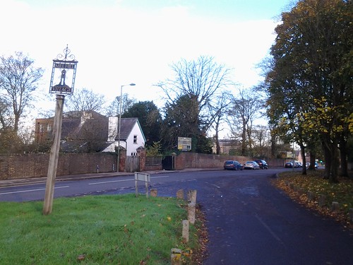
Stop 2: Lord’s Cricket Ground

Well we could hardly come to St John’s Wood without seeing Lord’s Cricket Ground.

In 1950 the architectural historian Pevsner was of the opinion that this was “a  jumble without aesthetic aspirations, quite unthinkable in a country like Holland or Sweden”. But since the mid 1980s various dramatic additions have been made – the one which is really visible from outside is the media centre, a tube made of aluminium dating from the late 1990s.

IMG_9590

IMG_9606

Lord’s maybe a bastion of “the Establishment” but the name as no connection with the House of Lords, as some people might think. It was actually established by a man called Thomas Lord (1755 – 1832). He was a professional cricketer who made 90 known appearances in first class cricket. He was mostly associated with Middlesex and with Marylebone Cricket Club (MCC) .

I always thought it odd that MCC was here given this is not actually Marylebone. However it was within the old borough of St Marylebone and actually the first Lord’s cricket ground opened in 1787 was a stone’s throw (or should I say a cricket ball’s throw) from Marylebone station, in Dorset Square.

Lord relocated in 1811 to a site at Lisson Grove but had to move again after three years because the land was needed for the Regent’s Canal. So finally it got to the present site in 1814, so this ground has been used for cricket for 200 years.

More about Lords on this link: http://www.lords.org/history/

We will see one of the entrances in Wellington Place. Passing this, turn right into the main road (Wellington Road) and continue along the side of the ground to the roundabout.

Look back and see this panel at the corner.

IMG_9602

Cross the road and our next stop is right ahead.

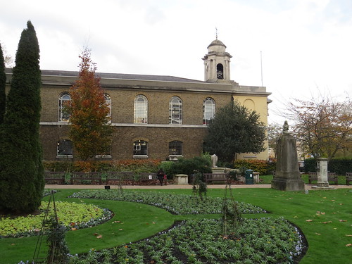
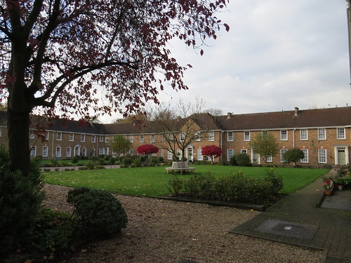
Stop 3: St John’s Church and gardens

Not surprisingly the church is called St John’s.

IMG_9592

The land here was bought in 1807 for a burial ground and the church was completed in 1814. Initially it was a Chapel of Ease for St Marylebone (ie a subsidiary church within the parish) but it later became a parish church in its own right.

IMG_9591

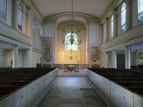
It has a very stark interior – all dusky white with very uncomfortable looking box pews.

IMG_9594

Walk into the gardens (the former burial ground) to the left of the front of the church and exit at the far side into Wellington Place. Going out of the garden here, turn right and go along Wellington Place until you reach St John’s Wood High Street where you will turn left.

Perhaps we might pause a while at this junction whilst I explain about a little footnote in history of dog ownership.

IMG_9581

In early 1992, I was working at the Department of the Environment and charged with implementing new legislative provisions requiring local authorities in England and Wales to have dog wardens. To co-incide with this, the Department ran a campaign to encourage people to clear up after their dogs. This was launched by the then newly appointed junior Environment Minister, Lord Strathclyde. But where to have the launch?

As it happened I discovered that Westminster Council had just put up two poop scoop vending machines in St John’s Wood (they were condom machines converted to dispense poop scoop plastic bags). So I suggested that the launch should be here – and it was! The machines are long gone but they were alongside these gardens. And I guess it is a measure of how far we have come that it is generally the norm now that people do pick up after their dogs.

That was a great job (really! I got a lot of responsibility because no one wanted to be associated with this policy area, so I was left to get on with it).

And as I used to say: “It may be dog mess to you but it’s my bread and butter”

Walk along the High Street to Number 45a.

Stop 4: Number 45a St John’s Wood High Street

This stop is just opposite the junction with Allitsen Road and, as you can see from the plaque, composer Benjamin Britten (1913 – 1976) and singer Peter Pears (1910 – 1986) lived and worked here between 1943 and 1946. I am guessing in the flat above the shop rather than the shop itself.

IMG_9576

IMG_9579

Seems a strangely unprepossessing location to find they lived, but Britten did also have a house in Suffolk he had bought with a legacy from his mother. Britten was a major figure in 20th century British classical music. But it was only with his work Peter Grimes in 1945 that he became internationally known.

Go down Allitsen Road until you reach Charlbert Street

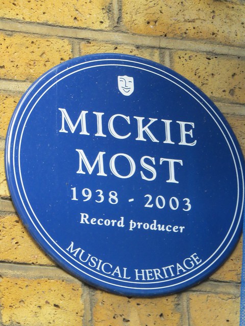
Stop 5: RAK Recording Studios

Just ahead of you to the right in Charlbert Street you can see our next stop.

The studios were set up by RAK records which was created by legendary record producer Mickie Most (Michael Peter Hayes: 1938 – 2003). He was part of a duo in the mid 1950s called the Most Brothers and in 1959 he renamed himself Mickie Most. He had quite a bit of success in South Africa but apparently tired of the touring.

After a spell selling records he got into producing and ended up producing some of the famous hits for groups such as the Animals (including House of the Rising Sun) and Herman’s Hermits (including I’m into Something Good) . Other artists associated with him were Lulu, Donovan, Suzy Quatro and Kim Wilde.

IMG_9570

IMG_9568

In the late 1960s he got into management, and in 1969 started his own record label (RAK records) and his own music publishing business, The name RAK  is said to hark back to the days when he was selling records and displaying them on racks. Then in 1976 he opened his own recording studios here in a converted Victorian school house in NW8. RAK records was sold to EMI in 1986.

A bit more info on RAK studios website: http://rakstudios.co.uk/history

Go up Charlbert Street away from RAK studios (as if you had done a left turn off Allitsen Road). At St John’s Wood Terrace turn right and a little way on the left past the former Chapel with columns is our next stop.

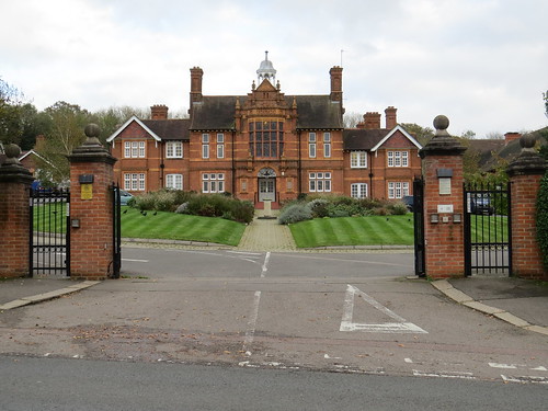
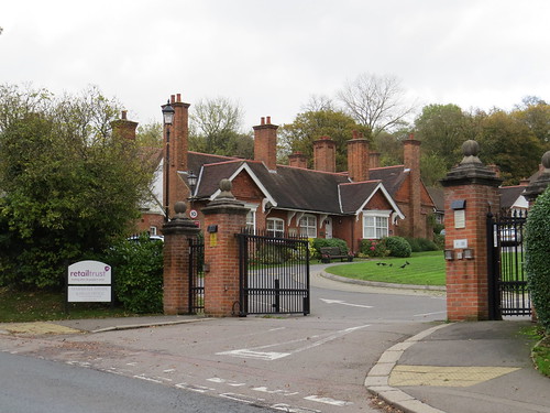
Stop 6: St Marylebone Almshouses

IMG_9562

IMG_9566

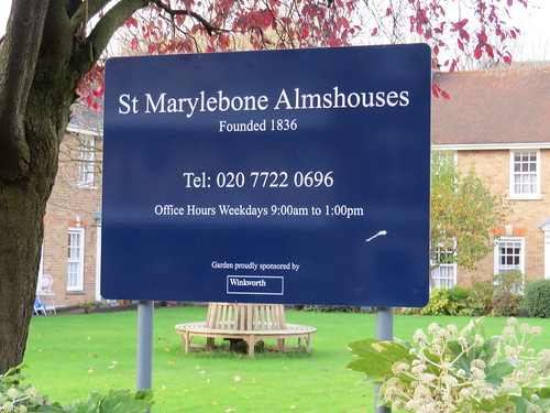
These almshouses are at the corner of Woronzow Road.

IMG_9567

Count Simon Woronzow was Russian Ambassador to the United Kingdom from 1784 to 1806.  He lived in the area and on his death in 1832 he left a bequest for the poor of the parish.  The money was used to build these Almshouses in 1836 but what we see today is a 1960 rebuild. More info on this link:

http://www.londonremembers.com/memorials/count-simon-woronzow

Retrace your steps along St John’s Wood Terrace and then right into Ordance Hill. It does not look much of a hill but the name Ordance does give away the original function of our next stop, which is up on the left  about opposite Norfolk Road.

Stop 7: former St John’s Wood Barracks

Some troops had been billeted in farm buildings here from 1804. But in 1810 the Board of Ordnance decided to base an artillery brigade here on land leased from the Eyre family who had acquired most of the land hereabouts in 1732. In 1823 the Cavalry Riding Establishment moved in and a new riding school was built for them in 1825.

In 1880 the Royal Horse Artillery moved in and continuously occupied the barracks until February 2012, when the lease expired.

IMG_9560

In November 2011 Ananda Krishnan, a rich Asian businessman, acquired the Barracks from the Eyre estate for £250m. The site is set to be developed as a residential estate and the 1825 Riding School (which is Grade II listed) will apparently be used to accommodate a gym.

There is an interesting looking relief on one of the buildings, but I could not get any closer.

IMG_9561

Continue along Ordance Hill and turn left into Queens Road. Our next stop is at the corner of the main road on your right.

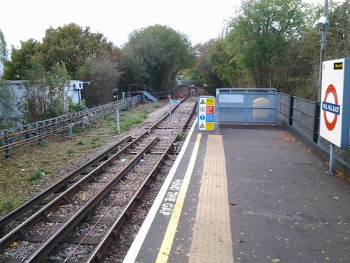
Stop 8: former Marlborough Road station

This was the street level building of Marlborough Road station which closed in 1939.

IMG_9556

It had opened in April 1868 on the northward extension of the Metropolitan Railway from Baker Street (which later became the Metropolitan line).

 By the 1930s the Metropolitan line was suffering congestion where the trains serving the various branches in the country had to share the limited capacity between Finchley Road and Baker Street. To ease this congestion, London Transport built deep-level tunnels between Finchley Road and the Bakerloo line tunnels at Baker Street, thus enabling the Metropolitan’s services toward Stanmore to be transferred to the Bakerloo line.
This transfer happened in November 1939 and subsequently in 1979 this arm of the Bakerloo line became  the Jubilee line).
As part of this a new tube station was built just down the road (which we shall see shortly). Marlborough Road closed and never reopened.
For many years this building was a restaurant. It was a traditional style restaurant when John Betjeman visited in his 1973 documentary Metro-land. Later it became a Chinese restaurant.
Transport for London took it back in about 2009 to houses a electricity substation installed as part of the power upgrade programme to support the introduction of new air conditioned Metropolitan line trains.

One little oddity about the station name is that the actual station fronts onto Queens Grove. Marlborough Road was on the other side of the main road but was renamed Marlborough Place in the 1950s.

Having turned left into Wellington Road, walk down here to the junction with Acacia Road. Just here is the “new” tube station, which was given the name St John’s Wood.

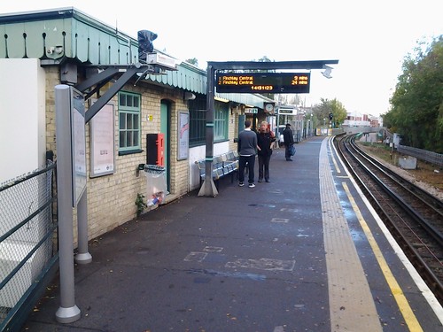
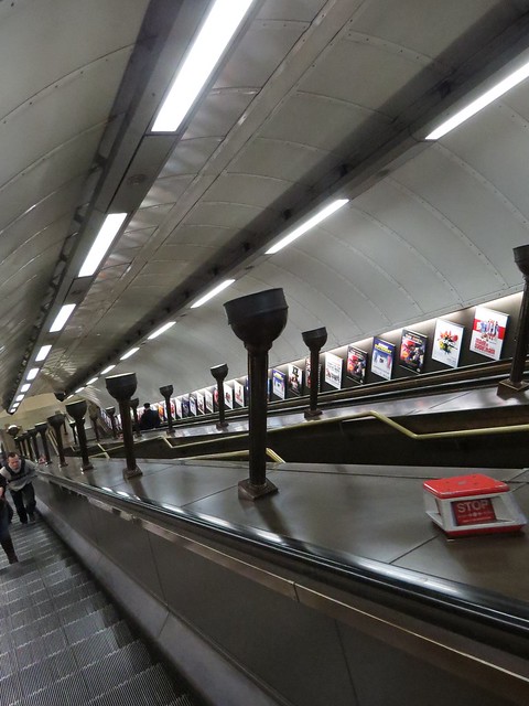
Stop 9: St John’s Wood Underground station

This is a lovely station and although it no longer has the original wooden escalators, it has retained the uplighters on the escalators.

IMG_9549

IMG_9546

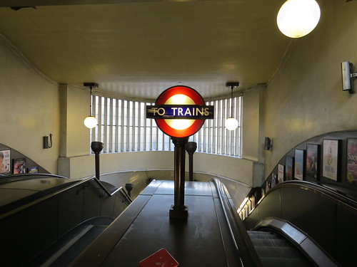
Today Transport for London gives St John’s Wood an apostrophe on maps and publicity whereas it does not have one in the tiling or signs on the platform.

IMG_9534

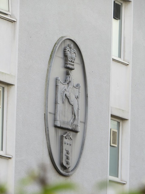
The stations built in this period had an unusual quirk in the tiling. Every so often there would be a tile with a picture or symbol on this. Sometimes but not always it was related to the station location. Here of course at St John’s Wood we have Thomas Lord.

IMG_9536

Useless fact: The station is apparently the only London Underground station whose name does not include any of the letters in the word “mackerel”

Cross over Wellington Road outside the station and go down the side road (Grove End Road). Our next stop is a little way along on the right.

Stop 10: Number 35 Grove End Road

This is one of the last survivors of the original buildings which were put up when this area was first developed in the 1820s and 1830s with detached and semi detached villas. Pevsner says “there was not much of individual note but the whole area had until the early 2oth century a character all of its own, a comfortable verdant, early Victorian character, never showy and never mean. It was largely destroyed by the building of large blocks of flats.”

Anyhow in the shadow of one of those blocks of flats is number 33 – home of Sir Thomas Beecham (1879 – 1961).

IMG_9617

IMG_9621

Sir Thomas Beecham  was an English conductor and impresario. He was best known for his association with the London Philharmonic and the Royal Philharmonic orchestras but he also had associations with the Liverpool Philharmonic and Hallé orchestras.

He was born to a rich industrial family in Lancashire. In 1842, his grandfather created a laxative marketed as  Beechams Pills and this was the start of the famous Beechams company, now subsumed within SmithKlineGlaxo.

Thomas Beecham started conducting in 1899. And for many years, he used his access to the family fortune to finance opera.

There is a great quote attributed to him:

“There are only two things requisite so far as the public is concerned for a good performance: that is for the orchestra to begin together and end together; in between it doesn’t matter much”

Our next stop is across the road.

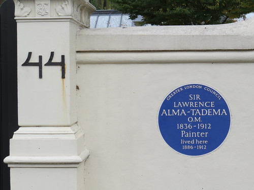
Stop 11: Number 44 Grove End Road

This was home of artist Sir Lawrence Alma-Tadema, (1836 – 1912). He was actually Dutch and trained in the Royal Academy of Antwerp, Belgium. He came to England in 1870 and spent the rest of his life here. He became famous for his depictions of the luxury and decadence of the Roman Empire, with scantily clad women draped in fabulous marbled interiors or against a backdrop of dazzling blues of the Mediterranean.

IMG_9623

IMG_9625

Keep walking along Grove End Road until you reach the junction with Abbey Road. Just over the way is the famous Abbey Road recording studios and that zebra crossing.

Stop 12: Abbey Road studios

Abbey Road Studios was established in November 1931 by the Gramophone Company, a predecessor of the famous record company EMI.

IMG_9633

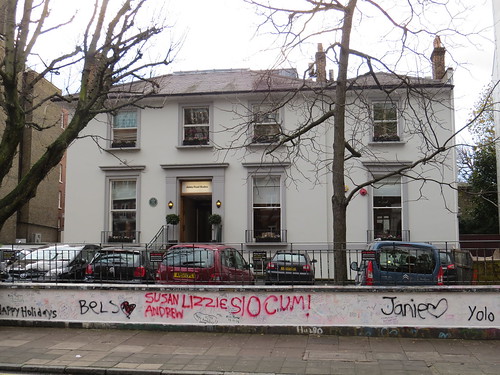
It was known for many years as the EMI studios and was only renamed Abbey Road studios in 1970 after the Beatles Abbey Road album had been issued.

Abbey Road Studios are regarded as the earliest, as well as the best-known, purpose-built recording studios in the world. After a scare in early 2010 that the studios might be sold for development the Government gave the studios Grade II listed status in February 2010, and its future does look more secure.

Following is an extract from the listing information on the Heritage Gateway site – www.heritagegateway.org.uk (I cannot seem to link to the actual page but you can find this by searching the listings using the exact phrase “Abbey Road Studios”)

“They were opened by Sir Edward Elgar in November 1931 and were used by a wide range of outstanding musicians. The studios cost £100,000 to buy, build and equip: the project was started by the Gramophone Company in 1929, which was soon after subsumed within the Electric & Musical Industries (EMI) company. Artists who have recorded here include Arthur Schnabel, Fats Waller, Noel Coward, Glen Miller, Marlene Dietrich, Gracie Fields, The Beatles, Pink Floyd etc. Abbey Road is known particularly for its close connection with The Beatles, over 190 of whose 210 recordings were made here with George Martin: their 1969 album was even named Abbey Road. Pink Floyd’s 1973 album ‘Dark Side of the Moon’ was recorded here in Studio Three. The studios are listed primarily for their considerable cultural importance and their place in the history of popular music, as well as their importance as a notable manifestation of the fast-developing technology of sound recording. The areas possessing special architectural and historic interest can be closely defined as Studios One and Two, and the street frontage.”

By the by, the first recording of George Harrison’s “My Sweet Lord” was by Billy Preston and not recorded here but at Olympic Studios. But the famous version by George was recorded here at Abbey Road in 1970.

And of course you cannot come to Abbey Road without using the famous Zebra Crossing

IMG_9636

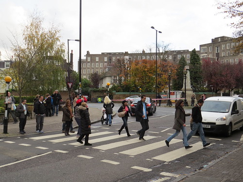
Except it is said that some years ago Westminster Council moved it so it is not exactly in the place where the famous Beatles picture was taken. The Heritage Gateway site says:

“… comparison between the [album] cover photograph and its present position suggests that it may have been moved a little to the north, closer to the studio gates, but it has not been possible to confirm this. Whether or not it is the same crossing depicted on the album cover or one very close to the original site, it remains a place of pilgrimage, with the studios, for Beatles fans from all over the world. Groups of tourists always gather to photograph the crossing and walk the walk and there is a live video streaming web-cam.”

Here is the link to the webcam, so you can check out who is crossing whenever you want!

http://www.abbeyroad.com/Crossing

And the crossing was given Grade II listed status by the Government in its own right in December 2010.

(But see the comment from Charlie which has a couple of links which set out the case that the crossing has not in fact moved!)

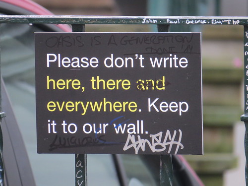
And I do love the sign at the front reminding people there is no public access to the car park at the front – this is a working studios afterall.

IMG_9634

and please only to write on the wall (that worked didn’t it)

IMG_9635

So this is the end of our NW8 walk proper. If you want to stop here, retrace your steps back along Grove End Road and you will be at St John’s Wood station. But if you have a moment, I do have this post script.

Post script:

I really wanted to include Crocker’s Folly in the walk. However I could not quite work out how to include it. Anyhow it is so special I had to include it as a postcript. To get there from Abbey Road studios walk down Grove End Road away from the studios and turn right into St John’s Wood Road. Go down the first left (Cunningham Place) and Crocker’s Folly is ahead on the corner with Aberdeen Place.

This Grade II* listed former pub was built in 1898, and was previously called “The Crown”.

IMG_9639

IMG_9640

In 1987, the pub’s name was changed to Crocker’s Folly. The story was that Frank Crocker built his hotel to serve the new terminus of the Great Central Railway. The station was actually built was about half a mile away at Marylebone. The legend goes that this lead to Crocker’s ruin, despair and eventual suicide, jumping from the window of an upper floor. Apparently this is an urban myth. Crocker did die in 1904, aged only 41, but of natural causes. But it is said that Crocker’s ghost haunts the building.

IMG_9648

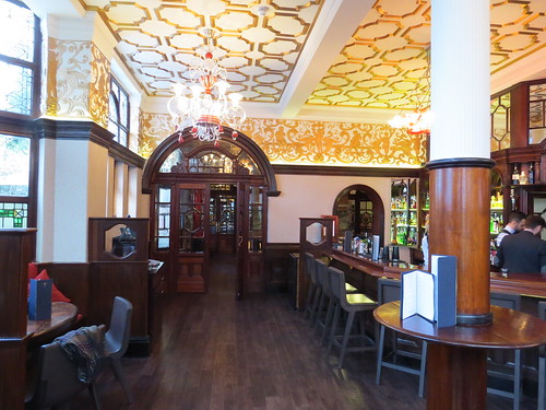
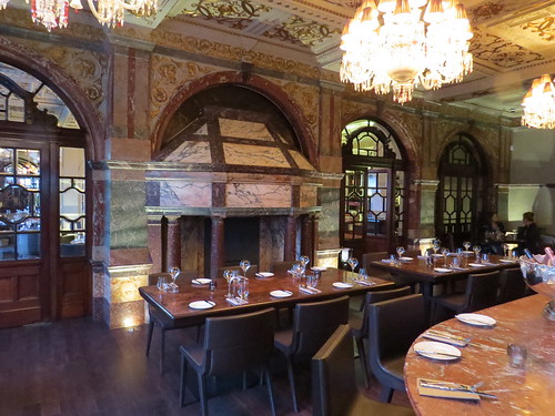
The highlight is the “grand saloon” as it was originally known. This has an exceptional marble fireplace, as well as a marble-topped bar counter, marble faced walls and a partly gilded beamed ceiling.

IMG_9642

More info on this link to Camra’s  website:

http://www.heritagepubs.org.uk/pubs/national-inventory-entry.asp?pubid=53

And you can go and have a lovely meal there in these beautiful surroundings. Not cheap but not mega expensive either – well worth a visit

http://www.crockersfolly.com/

So that really does bring us to the end of NW8.

If you are at Crocker’s Folly, you can walk down Aberdeen place to Edgware Road and buses.


NW7: East from Broadway

NW7 is practically in the country! Even though we are still in a London post code, we are at the very edge of built up London – unlike in the South West and West post districts where the London postcode area ends well before London does. Just to warn you some of the stops on this walk are quite a distance apart but that is the way it is out here “in the sticks”.

But it is not all countryside as can be seen from our first stop.

We start out walk at the main Post Office in Mill Hill Broadway. Turn right out of the Post Office and our first stop is ahead on the left.

Stop 1: Mill Hill Broadway station

Now this is an uninspiring station – and another one that has lost its original buildings and has little character as a result. But even worse the entrance is literally underneath the viaduct which carries the M1 motorway.

IMG_9306

IMG_9307

IMG_9323

IMG_9308

Hard to believe this station was actually built in 1868 by the Midland Railway, Then it was known as simply “Mill Hill”. It was renamed Mill Hill Broadway in 1950 presumably in recognition of the fact it is nowhere near the village of Mill Hill.

The station was reconstructed in the late 1960s when M1 motorway was built along the railway just here.  At least the motorway has been fitted in so it is not too intrusive here compared with say how Westway “fits” in. But it is still ugly and noisy.

Turn left out of the station forecourt and go under the motorway and railway.  At the roundabout take the left hand road. Cross when convenient as the pavement does not continue on the left hand side.

Stop 2: Bunn’s Lane “bridge”

Ahead where the pavement stops on the left, it seems like we are going over a bridge and yet looking over the parapet it is hard to see what is being crossed.

IMG_9312

To find out go past the walls and take a right into the park. Go down the steps and you will see a little pathway has been worn going into the undergrowth. Follow this and you can see the bricked up arches of a bridge.

IMG_9318

Here was an old railway, which originally ran from Finsbury Park to Edgware. It was promoted by the Edgware, Highgate and London Railway but before the line could open in 1867 the company was taken over by the Great Northern Railway.

In 1935 London Transport proposed as part of its new Works Programme an ambitious scheme called the Northern Heights which included taking over this line, making it double track and extending it beyond Edgware to Elstree and Bushey Heath. Work started before the war but with the war stopped and in fact so did passenger train services between Finchley and Edgware.

After the war, the area beyond Edgware was made part of the London’s new Green Belt, which in effect prevented the intended residential development, and the potential demand for services beyond Edgware vanished. Edgware was already served by the Underground and Mill Hill had the station we have just seen.That just left a little spur line to Mill Hill East which had re-opened  as a part of the Northern line in 1941 and which survives today. We will come to this at the end of the walk.

So with money short, available funds went towards completing the eastern extension of the Central line instead, and the Northern Heights plan was dropped in 1954. But the line through here to Edgware continued to be used for goods traffic, primarily coal, milk and building materials until 1964. Then it was abandoned, hence this bridge over nothing.

Now retrace your steps to Mill Hill Broadway and keep walking down the shopping street until nearly the end. Our next stop is by the corner of Hartley Avenue.

Stop 3: Athene House (former Capitol Cinema)

This green building may look like a modern office block but actually it was once a cinema called the Capitol.

IMG_9327

IMG_9329

According to the Cinema Treasures website, this was a conversion of the pre-existing Assembly Rooms by architect Robert Banks and probably opened in the 1920s. It does not seems to have been linked with any of the cinema chains.

The Capitol Cinema was closed in April 1955 and was converted into an office building. The front of the building has been rebuilt in glass and green panels, while some of the side wall has a corrugated covering.

Interesting that Mill Hill never seems to have had a large suburban style cinema of the kind we found in Hendon. Perhaps it just was not big enough.

Walk to the roundabout and cross the main road (A1) at the crossing to the right of the roundabout. Turn right after crossing and walk a short distance along the main road and veering off to the left is a street called Daws Lane. Go along here to the end (a kind of cross roads) and take a left into Hammers Lane.Our next stop is a fair way up this lane.

Stop 4: Marshalls Estate

Suddenly on the right you come across a late Victorian gated estate. This was created by James Marshall – son of one of the founders of the Marshall and Snelgrove Department stores. Dating from 1898 it was built not for himself but to provide housing for retired shop workers.

IMG_9336

IMG_9335

And it continues with this function today, under the auspices of a charity called Retail Trust. There are some 70 one bedroom cottages and flats on this site.

IMG_9337

Retail Trust website describes itself as “looking after the needs of all the three million people in retail, improving lives for all involved – yesterday, today and tomorrow. We are here to help with a wide range of services including debt advice, counselling, hardship grants, career development and retirement housing.”

And they do not just have this estate of retirement homes, they have four other estates in Derby, Glasgow, Liverpool and Salford. Well, who knew?

Retrace your steps back down Hammers Lane which continues after Daws lane as Wise Lane. After Mill Hill Park, take the first right which is called Parkside.

Stop 5: Number 32 Parkside

Keep walking along Parkside and on the right just before you get to a turning called The Rise, is Number 32. This was the home of racing driver Graham Hill (1929 – 1975), and it has a blue plaque to prove it.

IMG_9348

IMG_9346

He was a two time Formula One World Champion. He is the only driver to win the Triple Crown of Motorsport—the 24 Hours of Le Mans, Indianapolis 500 and the Monaco Grand Prix.

Should you be interested in such arcane information, here is a link to the Wikipedia page which explains a bit more about this mythical “Triple Crown” and also shows the drivers who did not quite manage it but have achieved two out of the three.

http://en.wikipedia.org/wiki/Triple_Crown_of_Motorsport

Hill and his son Damon are the only father and son pair both to have won the Formula One World Championship. And as Damon was born in 1960 this would have been his childhood home.

Continue walking along Parkside, past the roundabout (which has no apparent purpose). The road is now Hillside Grove. At the end turn right and then turn left into Bunn’s Lane. Our next stop is a short way along on the right at the corner of Colenso Drive.

Stop 6: John Laing’s offices

John Laing was for years a familiar name in construction. The business started in Cumbria in 1848. By 1920 the firm had become a limited company, and a couple of years later moved its headquarters from Carlisle to a 13 acre site at Mill Hill – which was just about where we are now.

Although they have moved the head quarters away and most of the site has been developed, they retain a little foothold here in Mill Hill as this building in Bunn’s Lane is where the John Laing Charitable Trust is based. The Trust exists to enable John Laing and its subsidiaries to make charitable donations and provide welfare support to existing and former employees.

IMG_9351

IMG_9350

Laing was responsible for building some of Britain’s landmark structures of the second half of the 20th Century – the initial stretches (Junctions 10 -18) of M1 motorway (1959), Coventry Cathedral (1962), Sizewell B nuclear power station (1995), the Second Severn Crossing (1996) and Cardiff’s Millennium Stadium (1999).

John Laing has not been involved in building and construction itself since the sales of its construction division in 2001, and of its property developments division and house building arm in 2002.

It now describes itself as: “a leading international infrastructure investor and asset manager. By combining its unique mix of technical, commercial and financial skills with those of its investment, construction and operational partners, the company has built a world-class reputation for efficiently delivering successful public infrastructure.” It is the private sector bit of many Public Private Partnerships which manage things like hospitals, waste and transport infrastructure.

One of Laing’s enterprises which has been in the news just recently is Agility Trains. This is a consortium with Hitachi and which has been awarded a contract to design, manufacture, and maintain the new fleet of long-distance trains for the East Coast and Great Western main lines.

Continue along Bunn’s Lane. At the end do a right then a left into Pursley Road. There is a fair trek along here past the school and playing fields. Walk until just before the road bends to the right, here take the left turn (Milespit Hill). A short distance along on the right is an entrance to Mill Hill Cemetery. Go in here.

Stop 7: Mill Hill Cemetery

This is another of the City of Westminster Cemeteries (like the one in Hanwell, W7) that Shirley Porter sold off cheap and Westminster City Council had to buy back expensively. There are a couple of things worth stopping for.

Follow the path from the gate (which is East Avenue) and soon on the left in the area called Plot L4 is the first of two civilian Second World War graves. This one is for people who died in Paddington and is here because at the time this was the Paddington Borough Council’s cemetery.

IMG_9357

And just a little further along in Plot L1 is a similar monument but this time for people killed by enemy action in Hendon. (Presumably Hendon Corporation did not run to its own cemetery).

IMG_9359

It’s noticeable how many fewer names there are on the Hendon stone but interesting nonetheless that there were still casualties out here.

Now head over towards the chapel and the A and B plots. Ahead from West Avenue beyond Plot A6 is a little graveyard dedicated to Netherlands war dead, with a  sculpture at the end.

IMG_9363

Retrace your steps and go parallel to the right hand boundary of the Netherlands War cemetery going into Plot B1. Here a little way along on the right is the grave of Billy Fury, who popped up in our NW6 walk.

IMG_9362

Now go back down West Avenue and you will soon be at the other entrance to the cemetery. Go out these gates and turn right up Milespit Hill. Going up this road does really have the feel of what you might call suburban countryside.

And then suddenly you find yourself by a pond with a red brick chapel ahead and to the left some almshouses. This really looks like a country village.

20141104_141638

20141104_141622

And just by the almshouses is a terrace of modern mews type buildings, called Angel Cottages.

Stop 8: Angel Cottages and The Nicholl Almshouses

The Nicholl Almshouses date from 1698 and architectural Historian Pevsner describes them as charmingly minimal.

IMG_9372

Angel Cottages on the other hand date from the mid 1960s and are by Richard Seifert and Partners – best known for Centrepoint and the Natwest Tower (now called Tower 42).

IMG_9376

Pevsner is not so sure about Angel Cottages, saying they “try to be sympathetic  by using red brick, timber boarding and tiled roof, but spoil the effect by intrusive mansards.” Perhaps that is a little hard on them especially given what else was being built in this period.

Fascinating fact: According to “A History of the County of Middlesex: Vol 5” (found on British History on line),

http://www.british-history.ac.uk/report.aspx?compid=26892

“Thomas Nicholl of Hendon erected a single storeyed brick alms-house at the junction of Milespit Hill and the Ridgeway, Mill Hill. He did not endow the premises, which accommodated 6 pauper residents of Hendon at a nominal rent, and the parish was forced to undertake repairs. Consequently the building was generally called the parish alms-house, although it was later known as Nicholl’s alms-house.”

So it just goes to show, Nicholl was not quite as generous as it might have seemed, and the parish ended up with the tab for maintaining the buildings.

Interestingly Richard Seifert lived locally. In 1946, when he returned from the army, Seifert bought himself a modest semi-detached house in Milespit Hill, which remained his home until his death in 2001. Rather than move, he enlarged it over time by purchasing and demolishing three neighbouring properties to make room for expansion.

Continue walking along this street which becomes possibly one of the shortest (and least commercial) high streets in London. There are no actual commercial premises here. As you get to the end take a look across the little green and main road at the white boarded property. This is our next stop.

Stop 9: Rosebank

This is a late 17th century house, which has a plaque announcing it was a Quaker Meeting house from 1678 to 1719.

20141104_141338

IMG_9379

It was apparently often visited by George Fox, founder of the Quakers. But he was always travelling around so I guess this is a claim for pretty much all the early Quaker meeting houses.

Continue along the main road and on your left are the various buildings of Mill Hill School.

Stop 10: Mill Hill School

Mill Hill School is a coeducational independent day and boarding school with around 640 pupils. It has an impressive array of buildings with a rather grand one built by Sir William Tite in the mid 1820s as its centrepiece. This was his first major work and he went on to build the Royal Exchange, South Metropolitan Cemetery in Norwood and a lot of railway stations, one of which we saw in SW13. And of course Tite Street in SW3 was named after him.

20141104_140809

IMG_9394

The site was the location of Ridgeway House which was the home of 18th century botanist and avid gardener Peter Collinson (1694 – 1768).

IMG_9382

Collinson was a cloth merchant, largely trading with North America, but his real love was gardening. In the 1730s he began importing seeds from North America for English collectors to grow the newly discovered plants here. Collinson maintained an extensive correspondence and was friendly with notable scientists in London and abroad including Hans Sloane, Carolus Linnaeus, and Benjamin Franklin.

One of Mill Hill school’s old boys was actor Patrick Troughton (1920 -1987) – best known as the second incarnation of Doctor Who (1966-1969 with brief returns in 1973, 1983 and 1985). And guess what the school’s theatre is called.

IMG_9387

He was in fact born in Mill Hill and a resident of Mill Hill for most of his life.

In the green just in front of the school is a war memorial.

IMG_9389

This turns out to be nothing to do with the school. It was transplanted here in 2012 from the site of  the Inglis Barracks which were down the road and are being redeveloped for housing. The Barracks were named after Lieutenant General Sir William Inglis, were built in 1905 as the depot for the Middlesex Regiment. The Barracks were also the location of the headquarters of the British Forces Post Office from 1963 to 1988.

Now cross the road and have a look at the church,.

Stop 11: St Paul’s church

This was built in the late 1820s (so just about the same time as the William Tite school building) as a chapel for the anti-slave campaigner, William Wilberforce, who had a house up the road on Highwood Hill. It was consecrated in 1833. Pevsner describes this church as “A typical cheap church of its date … cement rendered with the plainest of turrets…”. It does almost look like it is a film set.

IMG_9388

IMG_9393

It became the parish church in 1926

Now it is quite a way to get to Mill East Station and although there are some things on the way (the National Institute for Medical Research, started in 1938 and finished in 1950; the site of Inglis Barracks, now being redeveloped as housing), we have probably walked far enough, so I suggest hopping on a 240 bus to get you to Mill Hill East station, our final stop.

But I just have to include this just to reinforce the rural image – it is a picture taken at the end of St Vincents Lane, which is a little along the main road towards Mill Hill East.

20141104_142036

Stop 12: Mill Hill East station

This is perhaps one of the most unusual stations on the London Underground. It at the end of a single track spur line with just a single platform. Mill Hill East is one of only three (Chesham & Heathrow Terminal 4 are the others) Underground stations to have only one platform. It also one of the few Underground stations without any ticket barriers.

20141104_142911

20141104_143337

20141104_143140

We heard about the ambitions plans in the 1930s for this line but when the war came, a passenger service as part of the Northern line was created just to here in 1941 because of the Inglis Barracks. The Inglis Barracks site was sold by the Ministry of Defence in 2012 and is now being redeveloped for housing.

20141104_142814

Also just near this station was a gasworks established in 1862 by the North Middlesex Gas Company and the line was used to deliver coal to the works. The gasworks is now occupied by Waitrose.

Here by the way is a link to a fascinating story about a walk along the route of the disused line

http://underground-history.co.uk/northernh4.php

So we are now at the end of our NW7 journey. I was not expecting to find that Mill Hill Village was so different from Mill Hill Broadway or Mill Hill East. Or to find much of the area so “rural” in character, a housing estate for retired shop workers or a massive school with such impressive buildings.

You are now at Mill Hill East station which has a regular Underground service, although for most of the day you now have to change at Finchley Central.