SE4: Jack be nimble, Jack be quick

SE4 is Brockley which is one of those places one tends to pass by on a train – it being on the main line out of London Bridge towards Croydon and Brighton. But now I have the chance actually to walk round here.

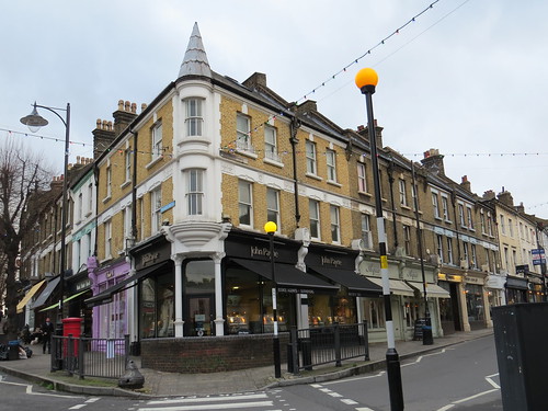
We start our walk at Brockley Post Office which is at 185 Brockley Road, SE4. Our first stop is just across the road and is a pub called the Brockley Barge..

Stop 1: Brockley Barge

IMG_1123

This seems to suggest there might be a canal here but there is not. At least not today. The name of this pub recalls the barges which plied their trade on the Croydon Canal. This canal opened in 1809 and ran from Croydon to New Cross where it joined the Great Surrey Canal to access the Thames.

It was not a financial success and it closed in 1836 – the first canal to be closed by Act of Parliament. The canal bought by a railway company, the London and Croydon Railway who used much of the route for their new railway from London Bridge to West Croydon, the latter station being built on the filled in basin at the southern end of the canal.


IMG_1124

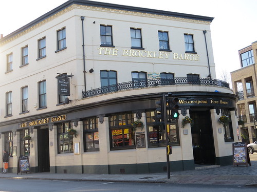
This pub was built in 1868 and was originally called the Breakspear Arms. It was rechristened the Brockley Barge in 2000 when it became a Wetherspoons.

Our next stop is a little way along Brockley Road as if you had turned right our of the Post Office. 

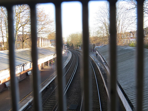
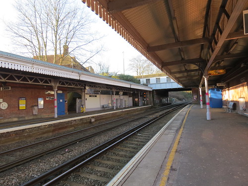
Stop 2: Brockley Station

The London and Croydon Railway opened through here in 1839, but Brockley did not get a station until March 1871, though there is precious little there today to suggest it was a Victorian station. The buildings are modern, but there is an old footbridge.

IMG_1206

There are four tracks here (two slow and two fast lines, with the fast ones together in the middle) but like all the stations between New Cross and Norwood Junction, Brockley only has platforms are the slow lines.

Today this station has 12 trains an hour. Four are Southern trains which go from London Bridge and end up at either Caterham or loop back to Victoria. The other 8 trains are the newish London Overground service extending the old East London line from New Cross Gate to either West Croydon or Crystal Palace. Must be slightly frustrating to be here if you want to get to central London when two thirds of your trains go on an arc around the centre. But at least they connect in with the tube quite well.

An interesting point to note about this station is that there is another railway line which passes over the end on the platforms.

IMG_1212

This was opened in June 1872 by the London, Chatham and Dover Railway on its Greenwich Park Branch Line and there was once a station here on this line, as we shall hear shortly.

Exit the station the way you came in and turn left and head back to the main road. Go under the railway bridge. Ahead is a junction which goes by the name of Brockley Cross.

Stop 3: Brockley Cross

IMG_1114

Before venturing to the mini roundabout that is now Brockley Cross. Just look to your left as you pass under the railway bridge. This is what is left of the entrance to Brockley Lane station.

IMG_1103

IMG_1105

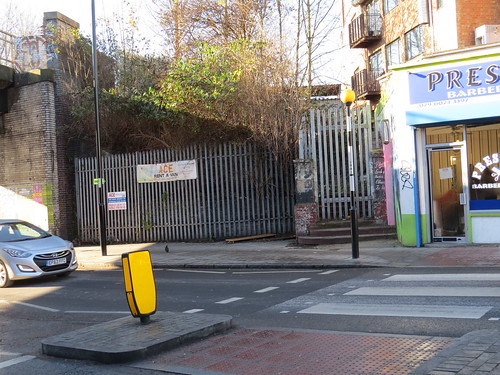
Brockley Lane is on that line that crosses over Brockley station. Brockley Lane station opened in 1872 but closed to passengers in January 1917 though it continued as a goods station until May 1970. There was a building at road level which was used as a shop until a fire in 2004. There is lots more info about this dead station at the wonderful Disused Stations site: http://www.disused-stations.org.uk/b/brockley_lane/

And according to the Disused Stations site, just across the road is the old station master’s house. Here it is today.

IMG_1200

I guess it would be too expensive to reopen the station and create an interchange at Brockley so you could travel from say Croydon or Norwood Junction to Lewisham  or  perhaps Blackheath without having to go up to London Bridge. This kind of orbital journey does happen and such an interchange might help reduce congestion in central London. Maybe one day.

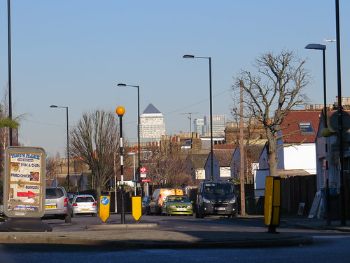
Now look ahead beyond the mini roundabout along Malpas Road and you get a view of some of the towers at Canary Wharf.

IMG_1109

Stop 4 The Tea Factory

Turn back look along Endwell Road from Brockley Cross and you see this strange sight looming up. It says on the side “Tea Factory”

IMG_1111

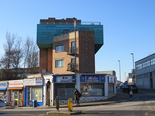
If you go along Endwell Road, you can see it full on.

IMG_1116

This was apparently constructed in the late 1940’s by the London Tea and Coffee Company whose original warehouse was destroyed in the Second World War. It is rather nicely done but it is in a strange location which must have delightful views of the two railway lines that cross near here.

Now head away from Brockley Cross along Godfrey Road. Our next stop is a little way along this street.

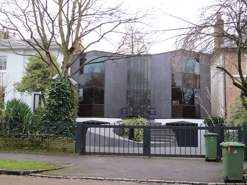
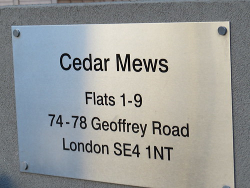
Stop 5: Cedar Mews, 74 – 78 Godfrey Road

My eye was taken by this rather handsome newish development on the right, called Cedar Mews.

IMG_1192

IMG_1193

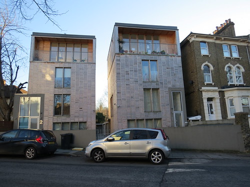
These apartment buildings have been fitted in and are the same scale as the 19th century houses nearby and yet they are completely different.

The buildings were completed in 2013 and are by West London based Groves Natcheva architects, who I have never heard of. They may not be to everyone’s taste but at least someone thought to make the effort.

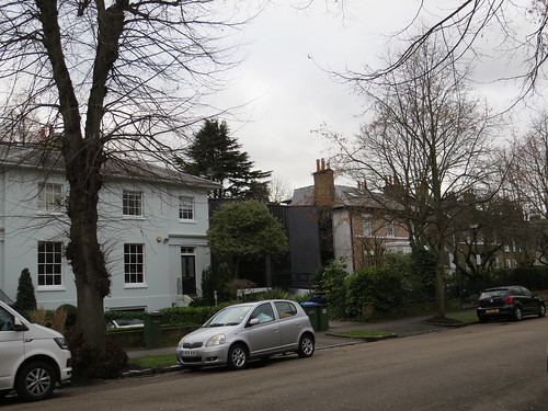
Keep walking along Godfrey Road to the end where you will reach Wickham Road. Just take a short detour to your left along Wickham Road to see Number 42.

Stop 6: Number 42 Wickham Road

IMG_1191

Unlikely as it may seem Lily Langtry, actress and mistress of the Prince of Wales, who is believed to have lived at 42 Wickham Road – at least according to Lewisham Council.

This is referred to in a council planning document about Brockley Conservation area: https://www.lewisham.gov.uk/myservices/planning/conservation/conservation-areas/Documents/BrockleyConservationAreaCharacterAppraisalPart1.pdf

Now head back along Wickham Road right to the end and you will be back at Brockley Road where you turn left. Our next stop is a little way along on the left.

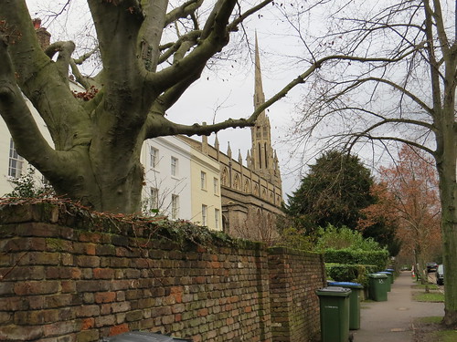
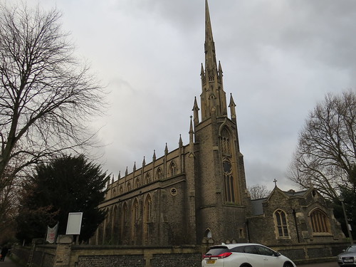
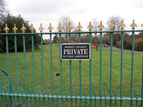
Stop 7: Brockley Cemetery

This entrance is to Brockley cemetery, although when it opened in 1858 it was called Deptford Cemetery.

IMG_1125

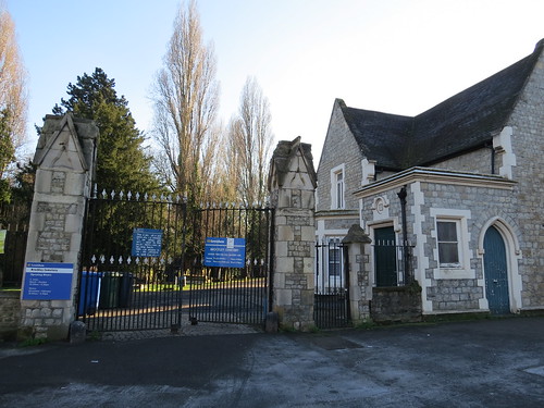
There is a helpful map on the right as you go in.

IMG_1127

It is a quiet well kept cemetery – not at all overwhelmed by vegetation.

IMG_1129

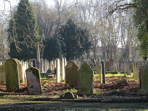
There are a couple of war memorials – both of which are of rather strange design.

First you will come across the Deptford War memorial.

IMG_1132

This has a column and then a big space with a back wall. in the space are a series of small marker stones with numbers – presumably they have some significance such as they are for the location of wreaths at the annual Remembrance Day ceremony.

Further on there is another war memorial, again an odd design which does not encourage you to approach closely.

IMG_1137

One curiosity about this cemetery is that it was actually two cemeteries and there was a wall between them until 1948. Just around here I think.

IMG_1149

The two were opened in the same year (1858) and the other was originally called Lewisham Cemetery and is now Ladywell Cemetery.

Just near the boundary between the two cemeteries is this interesting memorial which sits on its own.

IMG_1148

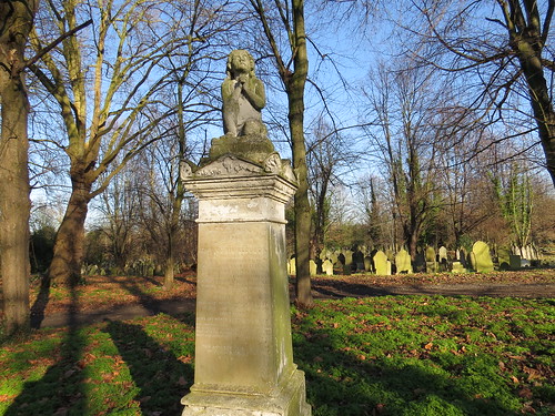
This monument tells a sad tale. Below the figure is an inscription detailing the horrific events surrounding the death of Jane Clouson on 25 April 1871.

It says: “A motherless girl who was murdered in Kidbrooke Lane, Eltham aged 17 in 1871. Her last words were, “Oh, let me die”.”

IMG_1147

The monument was funded by public subscription following the contentious trial and acquittal of Edmund Walter Pook, a printer from Greenwich, who had been accused of her murder.  More on that story can be found on Wikipedia https://en.wikipedia.org/wiki/Jane_Clouson

There is a site run by the Friends of Brockley and Ladywell Cemeteries which has some interest stuff about the cemetery. http://www.foblc.org.uk/

Retrace your steps to the main road and turn left. Our next stop is ahead on the left.

But going along you might spot some little reminders that this was once a tram route.

IMG_1181

These are relics of the London County Council (LCC) Tramway system. We saw some in Tooting SW17 and here they are again. The key thing which made the LCC system different was that there were no overhead wires. The trams got their power though a live rail in a conduit in the street. These manhole covers would have been part of that system. Amazing they are still here given that the trams were withdrawn from this street in 1952.

Our next stop is a little way on the left.

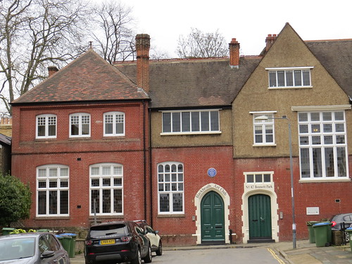
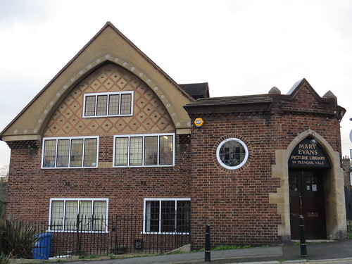
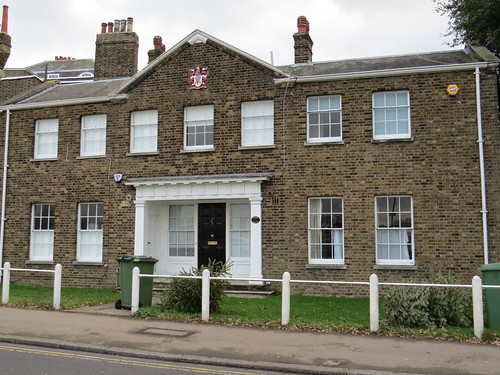
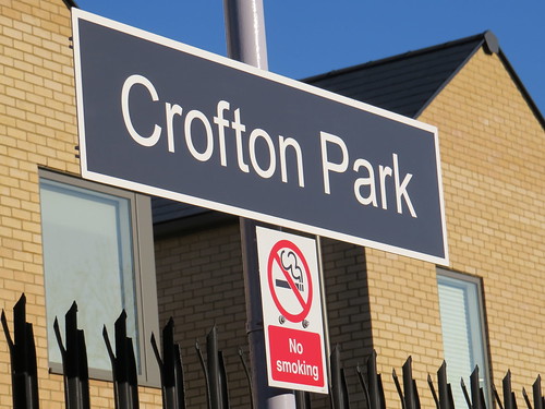
Stop 8: Crofton Park Library

This lovely building opened in 1905 and was funded by Scottish American industrialist and philanthropist Andrew Carnegie (1835 – 1919). It is one of around 19 he supported in Greater London.

IMG_1153

Although Crofton Park Library is part of Lewisham Library Service, for the past 5 or so years, it has been a volunteer run Community library hosted by an organisation called Eco Communities. It manages to open 5 days a week and maybe this volunteer model is the future for many libraries.

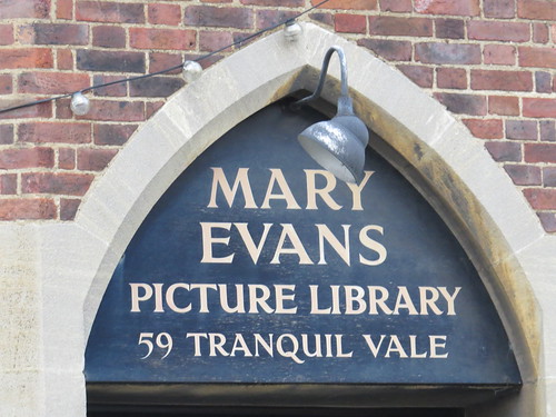
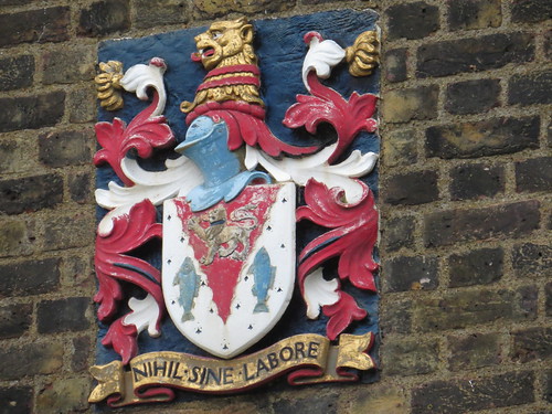
Note the crest over the door, with the motto “Salus Populi Suprema Lex”.

IMG_1152

This translates roughly as: “The welfare of the people shall be the supreme law” and is attributed to Cicero. This was the motto of the Metropolitan Borough of Lewisham  which was created in 1900 and it was taken up by its successor, the London Borough of Lewisham which was formed in 1965.

We are right by a railway bridge here and if you look over the road, you will see the side of our next stop.

Stop 9: Rivoli Ballroom

IMG_1158

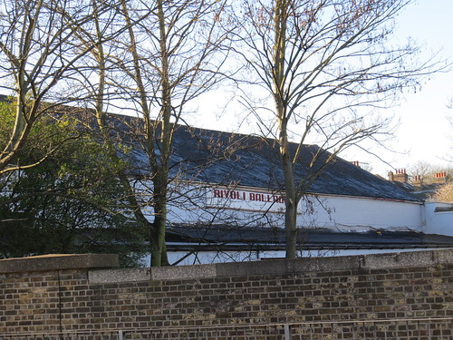
Keep going along the main road and you will see the front.

IMG_1154

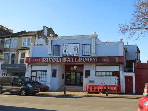
This is quite an amazing survivor.

The Rivoli started life as a cinema in July 1913 when it opened as the Picture Palace  According to the wonderful Cinema Treasures site:

“It soon became known as the Crofton Park Picture Palace and by 1918 was renamed Crofton Park Cinema. In 1931 it had been renamed Rivoli Cinema and some alterations had been carried out to modernise the buildings facade in a rather plain Art Deco style, plus a cafe was added to the facilities.”

It remained an Independently operated and owned cinema throughout it life. It closed on 2nd March 1957.  The building was boarded up for a couple of years and then reopened on 26th December 1959 as the Rivoli Ballroom. The interior is apparently much as it was from back then which makes it so special.

Despite threats to demolish the building in 2007, it remains open today catering to lovers of all sorts of dance and in February and April 2017, they are even having a pop up cinema over a couple of days.

Here is a link to their website for more info. https://www.rivoliballroom.com/

Our next stop is just across the road.

Stop 11: Crofton Park station

This is a strange little station which was opened by the London, Chatham and Dover railway in 1892 on what is known as the Catford Loop, which provided an alternative route for the Chatham line between Brixton and Shortlands. It also has a connection to the route into Blackfriars near Loughborough Junction which is where the trains go today

IMG_1177

IMG_1163

IMG_1165

But it is a rather poor train service. Only two trains an hour. they are Thameslink trains on the West Hampstead to Sevenoaks route. Unsurprisingly this station had only around 0.75m passengers in 2015/16 compared with over 4m at Brockley.

IMG_1168

Now if you have gone in the station, then come out and turn left and head along the main road. Our final stop is ahead on your right.

Stop 12: Brockley Jack

There has been a hostelry here for some time. For much of the 18th century it was known as “The Crooked Billet”, for much of the 19th century “The Castle”

The London Encyclopaedia says “Brockley remained agricultural until the 19th century, the only building of note being the Brockley Jack formerly a curious, rambling hostelry, reputedly the haunt of highwaymen”.

The pub was rebuilt in 1898 by the brewers Noakes. There are a couple of reminders of Noakes. High up on the left hand side you can see the words “Noakes Entire”.

IMG_1174

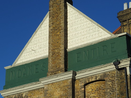
“Entire” originally meant a blend of three separate beers, consisting of one third each beer, ale, and strong beer. Initially it was mixed in the bar just before service but later it was mixed at the brewery and shipped out ready to be served..

And by the front door there is a foundation laid by Wickham Noakes.

IMG_1176

Noakes by the way was a local Brewery based in White Grounds, SE1 (which is just off Crucifix Lane close to London Bridge station). Noakes was taken over by Courage in 1930.

When the pub was rebuilt in 1898, it had a function room at the rear. This has been used for various things, such as a dance hall, a snooker room and a music venue. But since the early 90s, it has been used for theatrical performances. It now goes by the name of “The Jack Studio”.

The theatre website says: “In 2017 the Jack Studio the marks twenty three years of creating theatre. It is a vibrant and intimate performance space in south east London, with a long history both within its community and the London-wide theatre scene. We are committed to producing theatre that inspires, challenges and entertains our audience. The theatre is keen to continue its tradition of supporting new companies, providing a space for them to develop their work, alongside the productions created each year by the Jack’s in-house team.”

More info about the theatre and what’s on there at: http://www.brockleyjack.co.uk/

Well we have reached the end of our SE4 tour. Some interesting things along the way in the form of a couple of pubs, a couple of stations, a library and a dance hall.

I should just mention that there is a blue plaque in SE4 for the reporter and crime writer Edgar Wallace who lived at 6 Tressillian Crescent, SE4, but it was just a little too far off the route to include, but you could see it between stops 6 & 7. As you are heading along Wickham road, take a left along Harefield Road and keep going to the end

We are close by Crofton Park station with its pathetic train service, so you might want to jump on a bus back to Brockley or else go on to Forest Hill both of which have much better services.

SE3: Sun, Sand and Postcards on the edge…

SE3 is Blackheath, which centres on one of London’s suburban villages. It is an area with somewhat more character than the previous postcode, SE2.

We start our walk at Blackheath Post Office in Blackheath Grove. Head out of the Post Office towards the main road and station. The latter, which is over the road, is our first stop.

Stop 1: Blackheath station

The railway arrived in Blackheath in 1849 on a line from Gravesend towards Lewisham and on to London Bridge. The building at street level dates from 1879, but down at platform level are some original buildings.

IMG_0852

It has an odd arrangement in that the main access to the platforms does not go through the ticket hall. There are also no ticket barriers here because there is not really the space, so they just have the free standing Oyster validators.

IMG_0850

The London bound platform did have an adjoining bay platform which could be used for terminating trains from London. It is still here but overgrown and disconnected, now the platform has been extended to take longer trains.

IMG_0846

I have always been puzzled as to the railways in this part of South East London. There are three parallel lines which head out of London Bridge and come together again at Dartford. The northern one runs through Greenwich and Woolwich, the middle one through Bexleyheath and the southern one through Sidcup. But then there is this odd linking line connecting the northern and middle ones between Blackheath with Charlton. Why was this put in? The answer is that this link is the original line – the more direct route through Greenwich was only completed in 1878 and the line through Bexleyheath in 1895 (as we heard in SE2 in connection with William Morris’ travels to and from the Red House).

Now if you are in the station, head out on to the street, turn right and cross the road. Take the first turning on your left, which is Bennett Park

This short street has no less than three blue plaques. The first you come across is at Number 4 on the right. This is for Sir Arthur Eddington (1882-1944) who was a mathematician and astrophysicist. But I am going to skip him and focus on the other two.

Stop 2: Number 5 Bennett Park

This is on the left as you come down the road.

IMG_0859

And there is a blue plaque to graphic artist Donald McGill (1875 – 1962)

IMG_0861

McGill’s name is today synonymous with saucy seaside postcards. He was a naval draughtsman until 1904. An in-law encouraged him to design postcards after seeing an illustrated get-well card he had made for a sick nephew. Within a year it was his full-time occupation. He spent most of his life in the Blackheath area. Not sure how long he was living at 5 Bennett Park.

The cards feature stereotypical images of buxom young women, fat old ladies, drunken and/or lecherous middle aged men, honeymoon couples and vicars. He has been called ‘the king of the saucy postcard’. They are little well drawn masterpieces of social observation with a Music Hall sense of humour.

He did well out of this but even at the height of his fame he only earned three guineas a design, and he did not get anything when the image was continually reproduced.

Strange I do not know why but I kind of thought he was Scottish – probably the name and the sense of humour.

Continue along Bennett Park to the very end which is where our next stop is.

Stop 3: Number 47 Bennett Park

This rather lovely building has the words “Blackheath Arts Club” over the door on the left.

IMG_0863

The Blackheath Art Club was founded here in 1883 to:

“promote social intercourse among gentlemen interested in science, literature, painting and music in Blackheath and the neighbourhood”.

The purpose-built studios at 47 Bennett Park were intended to be commercially self-sustaining and subsidise the building of the art school and conservatoire but this never really worked out. The Art Club had its last exhibition in 1916 and the building was requisitioned by the Government for war use. The Club itself was wound up soon after the First World War.

The building then went through a variety of uses but was taken over in 1933 by the GPO Film Unit. Headed by a man called John Grierson, this Unit was set up to produce sponsored documentary films mainly related to the activities of the Post Office.The unit was a pioneer in making documentary films and had contributions from well known people such as Benjamin Britten, W.H. Auden, E.M. Forster and J.B Priestley.

IMG_0866

The GPO Film Unit became the Crown Film Unit in 1940 with a remit was to make films for the general public in Britain and abroad, basically moral boosting propaganda. This went on to become part of the Central Office of Information.

Today the building has been converted into flats.

Retrace your steps along Bennett Park and turn left at the end. Continue along here until the roundabout where our next stop is on the left.

Stop 4: Blackheath Halls

There are a pair of interesting buildings here. Blackheath Halls was established via a public subscription and built in 1895 by William Webster. The adjoining Conservatoire of Music and the School of Art, which you come to first, were completed in 1896.

IMG_0876

The Hall building has some lovely relief panels.

IMG_0878

IMG_0879

IMG_0897

The venue initially hosted orchestral and choral works with people like Dame Clara Butt and Percy Grainger appearing here.

During the 1980s the Halls were threatened with demolition but were saved with the support of local businesses and the community. After extensive renovation and restoration followed, the Halls reopened in 1991.

Blackheath Halls are now owned by Trinity Laban Conservatoire of Music and Dance. This was formed in 2005 as a merger of two older institutions – Trinity College of Music and Laban Dance Centre.

The Great Hall seats 600 and there is a 160 seat recital room.  The Halls cater for classical and non classical concerts as well as stand-up comedy.

Continue walking past the Halls and turn left down the first street.

Stop 5: Blackheath Park

This is a private street (or rather a group of streets) which the Cator estate.

IMG_0881

IMG_0880

According to architectural guru Pevsner, this area formerly belonged to Wrinklemarsh Manor, owned in the 17th century by Sir John Morden, more of whom anon. The estate passed through various hands until it was purchased in 1783 by a John Cator. He demolished the house and started to develop the land.

The street, Blackheath Park, dates from the early 1800s, and of course no such development would be complete without a church.

IMG_0882

This is St Michael and All Angels and is noticeable because of its very slender spire. The church itself also very slim profile. This was built in the late 1820s..

IMG_0884

IMG_0890

There are some interesting 19th century houses here and also some notable post war 20th century developments which have been fitted in, including a number by a company called Span who built some 13 developments within the Cator estate in the 1950s.

As you return back along Blackheath Park have a look out on the left for number 10 – a modern building which lurks like a stealth bomber in amongst the older stock.

IMG_0891

IMG_0894

This dates from 1968 and is by Patrick Gwynne. Very well done. At once uncompromisingly modern and yet not out of place as it does not shout its presence.

Now retrace your steps and leave the estate, going back past the Halls and the station. Just beyond the station the road splits.

IMG_0902

Take the left hand road. This is the centre of Blackheath Village and very lovely it is too.  This street is called Tranquil Vale which is a superb name, don’t you think? Go past the Crown pub.

IMG_0904

And our next stop is on the left.

Stop 6: Mary Evans Picture Library

This is the Mary Evans Picture Library. It is a private library which specialises in providing pictures for commercial use in books, newspapers, magazines, adverts, web sites and all manner of other media.

IMG_0906

IMG_0907

Mary Evans and her husband Hilary founded the library in 1964. Its core philosophy, unchanged for over 40 years, is “to make available and accessible all the wonderful images created for people to enjoy over the centuries which were originally published in books, on posters, in advertisements, or as prints”. This is not high art but “ordinary” images which display such skill and creativity on the part of the artist, and the style, medium and texture of which defined the era in which they were created.

Sadly this is not somewhere where you can just pop in and browse. But if you want to find out more follow this link: http://www.maryevans.com/about.php?pageName=about1&prv=%27menu%27

Ahead you will see the church of All Saints, our next stop.

Stop 7: All Saints Church

IMG_0915

All Saints Church dates from 1857 – 1867 and Pevsner describes it as “Puginian … already old fashioned.” going on to say “Remarkable for the way in which it is placed right into the heath. Surrounded on all sides by grass, it stands as if it were a model.”. Yes it does look slightly unreal.

But the other unreal thing about this spot is the fact you can see the tops of some of the Canary Wharf towers in the distance.

IMG_0918

There is so much I could cover here about the heath and the village,

IMG_0921

But I want to press on as there are some things a little further afield I would like to get to. However as a result the rest of the walk is a bit spread out.

From the Church follow the edge of the heath, passing by the Clarendon Hotel and the Princess of Wales pub. Keeping the heath to your left, turn along South Row. Note the rather lovely early 18th century building to your right.


IMG_0952

With this crest.

IMG_0953

The crest has the motto “Nihil sine labore” which is often translated as “Without work there is nothing”. In other words you have to work for things.

Continue walking along side the heath and our next stop is on your right.

Stop 8: The Paragon

This is at the other end of the Blackheath Park development and is called The Paragon.

IMG_0957

It is a rather grand sweeping crescent overlooking the heath. It was built over a period of years from 1794 to 1807 and is part of the Cator estate.

IMG_0959

IMG_0960

The road is private and guarded by a small lodge at each end. Pevsner says these are post war creations but comments they are “entirely convincing”.

Then just ahead you will see a green space with a gatehouse. That is our next stop, or rather will be, when we get to it.

Stop 9: Morden College

IMG_0961

IMG_0964

So far so uninviting. But look to your left and you will see a sign for a footpath – not any old footpath but the “Sir John Morden Walk, London SE3” no less.

IMG_0966

Go down here because that way you can see the historic building at the heart of the college.

Confusingly Morden College is not an educational establishment and self evidently it is not in the place called Morden..

Their website http://www.mordencollege.org.uk/ explains:

“Sir John Morden, born in 1623, was a merchant, a member of both the Turkey (Levant ) Company, and of the East India Company. From 1669, with his wife, Dame Susan, he lived at Wricklemarsh Manor, Blackheath.”

He founded his College to provide accommodation and support for merchants like himself, but who had fallen on hard times through no fault of their own; were single, either widowers or bachelors; of a minimum age of 50 years, and members of the Church of England.

As you walk along the path the main building appears on your right.

IMG_0971

The original College was built between 1695 and 1700 in the style of Wren: This had 40 apartments around a quadrangle, with a Chapel all of which were set in gracious grounds.

IMG_0976

Since the Second World War more accommodation has been built in Blackheath and also Beckenham, raising the capacity from 40 to 400.

So basically this is rather unusual old people’s home.

Keep walking along the path and you will reach a street. this is Kidbrooke Grove. Cross over tis and keep going down the path which leads you to Kidbrooke Park Road. When you get here turn left and go to the end. This is Shooter Hill Road. Hard to believe this is the A2, the main road to North Kent and Dover.

Turn right here and walk on to our next stop.

Stop 10: The Sun in the Sands pub

This is one of those names which you hear a lot on traffic reports as it is a junction on the A2 and Blackwell Tunnel Southern Approach. You cannot immediately see the latter as it runs below the roundabout in a cutting.

IMG_0977

The junction gets its name from a pub, which you can see on the far side of the road interchange.

IMG_0989

This is an unusual pub name and the Dictionary of Pub Names says the name comes from the sight of the setting sun amidst dust, kicked up by sheep herded by drovers from Kent travelling towards London. However Greenwich Council says in its “Sun in the Sands Conservation Area Character Appraisal (Adopted 26 September 2007)” that “The name “Sun in the Sands” refers to the sand pits formerly around the pub.”

This document also says: “A building on this site appears on Rocque’s 1745 map, and this appears on Hasted’s Plan in his 1778 History of Kent. The first reference to a public house appears in the 1790s rate books, the ‘Sun Ale House’ is recorded as such in 1812. This building seems to be the  same as that illustrated in the 1830 watercolour reproduced above on the front page. The present Sun in the Sands Public House is said to date from 1842 – and is believed to have been substantially rebuilt at the end of the 19th century. However comparison of the photos below of the present building with the 1830 drawing shows that the pub retains the same form – wide gable ends and 5 bay width which were there and already ‘old’ in 1830. This suggests that, whilst no doubt much altered and rebuilt, the building frame predates the 1840s and is likely to be substantially the 18th century one seen in the 1830s watercolour.”

So it has a bit of history.

Sad it looks like this, with the Blackwall Tunnel southern approach thundering under the roundabout.

IMG_0987

Now go over to the far side of the roundabout on the other side of the Blackwall Tunnel southern approach road from the Sun in the Sands pub. You will see a pathway which parallels the main road go along this. This leads to a road which you should follow. Take a left at the end (which is Old Dover Road). Go along here through a small shopping area and past a library. Our next stop is just before the end on the left.

Stop 11: site of an old cinema, Old Dover Road

Hard to see now but this M & S Food store is on the site of an old cinema

IMG_1002

The cinema was originally called the Roxy and opened in 1935. The newly built cinema building was taken over by Associated British Cinemas(ABC). According to the wonderful Cinema Treasures site “it was not designed by their usual in-house architect W.R. Glen, but by noted theatre architect Bertie Crewe”. It was closed by war-time damage and only reopened in January 1947. It was renamed ABC in 1963 and survived as a cinema until February 1974.

The cinema was demolished in the spring of 1981 and a rather uninspired supermarket structure was built on the site. Not sure what it was when it opened but it is now an M & S.

Go to the end of the road and ahead you will see a green. Cross over to the other side of the green and our final stop is straight ahead.

Stop 12: Pegga Stores, Number 188 Westcombe Hill

This is an old fashioned survivor of a shop. It is called Pegga Stores and sells greeting cards and small gifts

IMG_1012

For 45 years this was the domain of Peggy Hawkes – and Londonist told the story in a great article about the shop in 2016.

http://londonist.com/2016/01/pegga

She had started working at the local newsagents/stationers for an elderly couple, the Munns. Her son, Andrew, cannot be sure 188 Westcombe Hill has been a stationer’s since it was built but he does know the Munns had it for 50 years before they retired, a year or so into Peggy’s employment.

“She was horrified to think she’d lose her job,” says Andrew. “So the family got together and bought the shop.”

For local people Peggy’s passing in December 2015 brought a mixture of sadness, disbelief — she was an institution no one imagined could die — and fear.

“Everyone’s been asking ‘are you going to sell the shop; are you going to change it?’ We’re not. We love it,” says Andrew. “But we will clean.”

“People try to buy the shop all the time,” says Andrew. “We get notes shoved under the door (there’s no letterbox) and people even come in. Mum used to send them away with a flea in their ear.

“Me and Angie are going to give this a go.” Angela Wing worked with Peggy for many years and also has no intention of changing anything.

IMG_1013

IMG_1014

The question which does remain unanswered is why is it called Pegga store and not Peggy? Even her son does not the answer to that one.

So we have now reached the end of our SE3 walk. We have seen quite a bit of one of London’s lovely suburban villages with some interesting historic connections, including a college which is not a college and a church which looks like a model.

We are a bit of a way from a station here but you can get buses 54, 108 or 202 back to Blackheath station or else you have buses 108, 286 or 422 to Westcombe Park station

SE2: Knee hill-ism

SE2 is Abbey Wood. This postcode is actually the furthest east of the London postcodes. The area cannot be said to have much of interest and this is somewhat of a contrast to the previous postcode SE1. But as ever we will find enough to entertain ourselves.

We start our walk at Abbey Wood Post Office, 90 Abbey Wood Road, which is in the heart of what is called “Abbey Wood Village”

Stop 1: Abbey Wood Village

IMG_0826

Sadly the reality is a little disappointing. This is not some quaint historic village but a short street of rather nondescript shops. Perhaps the only points worth commenting on is that there seem to be no charity shops and only one empty one. However the selection of shops is somewhat pedestrian.

IMG_0831

Then there is a dull looking pub – the Abbey Arms – at the end.

IMG_0834

There really is not much to detain us in this “village”. Just beyond the pub is our next stop.

Stop 2: Abbey Wood Station

Abbey Wood railway station was opened in 1849, although there is nothing left to suggest that there was an old station here. It is being rebuilt and will be the end of one of the branches of Crossrail. The new station is emerging and will look quite impressive – it certainly will stand out in this otherwise dull area.

IMG_0720

IMG_0840

There will be two pairs of platforms by the look of it. On the south side will be the Southeatern services and on the north side will be the new Crossrail services.

IMG_0719

IMG_0715

IMG_0710

IMG_0842

It does not look like they have arranged things so there could be a cross platform interchange with Crossrail. This maybe could have been done if Crossrail lines had been placed in the middle. Thus terminating Crossrail trains could have had a cross platform connection with the Kent bound trains and then they could head out and reverse and go back west from the platform adjacent to the London bound Southeastern services. And if they ever extend Cross rail services into Kent that arrangement would make life easier.

Now retrace you steps back through the “village” and turn left by the Post Office and go under the flyover. This is called Abbey Road and goes under a road called Harrow Manorway.

Stop 3: Harrow Manorway

I pause here because this massive flyover and car park beneath seems quite out of keeping with the area.

IMG_0723

The flyover carries a road called Harrow Manorway and was built in the 1960s to replace a level crossing when nearby Thamesmead was being developed. Here is a view from above, should you be interested. It feels like it should have been part of a bigger road scheme but it just ends here in Abbey Wood.

IMG_0779

Keep walking along Abbey Road. We are heading for Lesnes Abbey.  Lesnes Abbey of course is how the Abbey part of Abbey Wood came about.

Ignore the sign pointing to Lesnes Abbey which sends you up New Road. Instead keep going and you will an open space on you left. Ahead is a concrete bridge over the road. This carries the Green Chain walk – a linked system of open spaces between the River Thames and Crystal Palace Park in South East London.

IMG_0729

It is here you should leave Abbey Road, by climbing the steps and onto the path leading to our next stop.

Stop 4: Lesnes Abbey

This open space contains the ruins of a 12th century Abbey – the Abbey of St Mary and St Thomas the Martyr founded in 1178 by Richard de Luci (or Lucy)

IMG_0736

IMG_0766

According to Bexley Council’s website: “De Luci, who had supported Henry II in his dispute with Thomas Becket, which ended with Becket’s murder in Canterbury Cathedral in 1170, probably founded [the Abbey] as an act of penance.”

“Lesnes was not a large or wealthy foundation. Throughout much of its existence, the abbey was in financial difficulties. This was partly caused by the expense of maintaining the river walls and draining the marshes along the banks of the Thames. This reclamation helped transform the land from unusable marsh to valuable pasture. Nevertheless, the abbey gradually built up debts and through the fourteenth century its buildings fell into neglect.”

It never became a large community, and was closed by Cardinal Wolsey in 1525, under a licence to suppress monasteries of less than seven inmates. Lesnes, with only an abbot and five canons, became one of the first monasteries to be suppressed in England. Most of the monastic buildings were pulled down soon after the dissolution, Henry Cooke, who acquired the site in 1541, retained the Abbot’s Lodging for the manor of Lesnes.

It eventually passed to Sir John Hippersley who having salvaged building materials, sold the property to Thomas Hawes of London in 1632. It was then bequeathed to Christ’s Hospital in 1633. They kept it until 1930, when the London County Council purchased it. In 1931 Lesnes Abbey was opened to the public as a park. Ownership transferred to the London Borough of Bexley in 1986.

More info at: http://www.bexley.gov.uk/article/3907/Lesnes-Abbey-ruins

There are a few things to explore here.

Go up to the left and you will see an old Mulberry Tree.

IMG_0735

The sign says this was part of a failed attempt during the reign of King James I in the early 17th century to create home grown silk.

IMG_0734

And beyond that is a viewing area.

IMG_0750

There are plans to provide signage about the park’s history and the landscape beyond and  there is going to be what is called “interpretive abbey windows” to “help to help frame to views across Thamesmead, Woolwich, Dagenham and all the way to central and south east London.” There are just the stubs where the “window” will stand but in the distance you can just about make out the towers of Canary Wharf.

IMG_0756

In the woods behind, there is a “fossil wood” with a rather splendid carved beast of some kind.

IMG_0759

A bit of investigating suggests this is a “Coryphodon” (there is more info about this kind of prehistoric beast on wikipedia if you are interested!  https://en.wikipedia.org/wiki/Coryphodon )

IMG_0763

I could not see any actual fossils (but maybe I was not looking properly) but they did have some plaques which indications of the kind of fossils I guess were found hereabouts.

IMG_0760

It seems you are sort of free to go rummaging round here to look for fossils – subject to certain rules:

http://www.bexley.gov.uk/article/3912/Fossil-bed

Return back to the ruins, which are worth a little wander round. Within the ruins are some signs to indicate what the various areas were used for.

IMG_0737

IMG_0739

Bexley’s website says: “Rosesia was the great granddaughter of Sir Richard de Lucy, and as a young girl she was raised at Lesnes Abbey… She eventually married and moved away, becoming Roesia de Dover. However, when she died her heart was buried at Lesnes Abbey as a relic to be prayed for in order to speed the passage of her soul through purgatory.”

Beyond the main ruins is an enclosed area which is called the Monk’s Garden, which is being developed with plants typical of when this was a religious establishment.

IMG_0744

Now head off towards the new structure with the green roof, which was shut up on my visit but is supposedly a visitor centre of some kind.

IMG_0768

Keeping this building to your right leave the open space and turn right into New Road. Go down New Road to the end and turn left back along Abbey Road. Just before the flyover, turn left into Manorside Close and go along the little path head which takes you up to the roundabout where Harrow Manorway meets Knee Hill, which is our next stop.

Stop 5: Knee Hill

Head up the street called Knee Hill but look out over the open space to your left,

IMG_0780

You will see a stone plaque (almost opposite the end of Federation Road)

IMG_0788

This commemorates a connection with William Morris who lived at the nearby Red House, in Bexleyheath from its completion in 1860 until 1865. Morris regularly walked to Abbey Wood station. He also used a decorated wagon to  travel between Abbey Wood station and Red House, Bexleyheath. Clearly this area was then poorly served by train. In fact the line through Bexleyheath (which today provides a nearer station to Red House) only opened in 1895.

IMG_0787

By the way “Si je puis” (If I can, in English) was Morris’s motto and can be found in a tile in the porch at Red House.

This, it seems, is the nearest Abbey Wood can get to a blue plaque – and it is not even blue and it only commemorates that someone famous passed by!

Now the name of this place brought to mind that it sounded like it might have something to do with nihilism. In philosophy nihilism is: “the belief that nothing in the world has a real existence.”. Perhaps this is kind of fitting for SE2 which is a kind of uninspiring non-place where the only thing which is deemed worth remembering is something so fleeting that it hardly had any real existence.

Now back in the “real” world, take a right into Federation Road.

Stop 6: Caravan Club

Just along here on the left is a surprising sight – a camping and caravan site which is owned and operated by The Caravan Club.

IMG_0791

The Club was founded in 1907 as The Caravan Club of Great Britain and Ireland. Its aim was to “… bring together those interested in van life as a pastime…to improve and supply suitable vans and other appliances…to develop the pastime by collecting, publishing and supplying to members, books and periodicals and lists of camp sites etc… to arrange camping grounds.” Now known simply as the Caravan Club it runs some 200 sites of which this is one of two in Greater London.

Just seems kind of odd to find a place like this here.

Now keep walking along Federation Road

Stop 7: Co-op Estate

The houses here were developed by the Royal Arsenal Co-operative Society (RACS). They owned two farms in the vicinity of Abbey Wood and created the Bostall Estate between 1900 and 1930. The housing is largely traditional terraced houses in yellow London brick, with gardens to the front and rear. This was apparently also known locally as “The Co-op Estate”

The streets are named after Co-operative themes (Alexander McLeod was the first secretary of the RACS, Rochdale was location of the first modern Co-op, Robert Owen is regarded as the father of the Co-operative movement, plus there are streets called Commonwealth, Congress, Conference and Federation). There were some shops but no public houses to tempt the good people of the estate.

IMG_0789

IMG_0821

IMG_0796

By the way I gather snooker champion Steve Davis lived in Commonwealth Way (don’t know exactly where) and went to Alexander McLeod Primary School and Abbey Wood Secondary School.

In the late 1950s the London County Council built the Abbey Estate starting with one road south of the railway and later extending on the northern side on former RACS marshland. The later in the mid-1960s the Greater London Council began building the first phase of Thamesmead on more ex-RACS land, north-east of Abbey Wood station. But that is now in SE28, so we will have to save that for a future date.

Now take a right down Shieldhall Street and ahead on the other side of McLeod Road is our next stop.

Stop 8: Greening Street Green

My eye was drawn to the open space ahead which is known as Greening Street Green.

IMG_0804

IMG_0807

It is a sad space imprisoned in a high wire mesh fence. Not at all inviting. It is almost as if the Council want to stop people using this. No doubt in the past it seemed a good idea to have this high fence stop balls escaping and dogs entering. But it really could be done better.

At the end of Shieldhall Street, I found our next stop.

Stop 9: Numbers 71 – 81 Abbey Wood Road

Facing on to Shieldhall Street and Greening Street are six terraced houses with names. They have the delusion of grandeur in that they are all “villas” despite being quite modest terraced houses.

IMG_0817

Starting on the left there is Stanley and Eric.

IMG_0808

And then there is Marie and Jessamine.

IMG_0809

And finally Hyacinth and Myrtle.

IMG_0813

Presumably these were relatives (or maybe friends) of the developer or builder. These people may have been so proud or honoured to have a house named after them. Their names live on it over the doorways of these six houses but who they were and why their names were chosen is I guess lost in the mists of time.

Walk along Abbey Wood Road as if you had done a right out of Shieldhall Street. Our next stop is ahead on the left

Stop 10: St Michael and All Angels Church

Architectural expert Pevsner normally so effusive in the description of churches simply mentions the existence of this one.

IMG_0820

IMG_0822

St. Michael and All Angels Parish Church opened in a temporary building in 1905. The permanent church, designed by well known church architect Sir Arthur Blomfield, was consecrated in 1908, and the original building became the church hall, which can be seen at the western end of the church…

Unusually for a church of this period the foundation stone is modest in the extreme.

IMG_0824

It does not even have a name, just saying “To the Glory of God June 15 1907”.

So that brings us to the end of our SE2 walk – well sort of.

Postscript

There is one thing which is really worth a visit in SE2 but it is a little too far to go to. That is the Crossness Pumping Station – a piece of wonderful Victorian engineering which was a key part of the sewage system created by Sir Joseph Bazelgette (1819 – 1891) in the 1860s.

Crossness is at the eastern end of the Southern Outfall Sewer and the facility included storage tanks and an engine to pump out the sewage on the falling tide.

IMG_0773

The Beam Engine House is a Grade 1 Listed Industrial Building constructed in the Romanesque style and features some spectacular ornamental Victorian cast ironwork. Today the Engine House is open for visits but the times are limited. See attached link:

http://www.crossness.org.uk/visit.html

A word of warning – according to TfL Journey Planner, the nearest bus stop to the Crossness site is some 28 minutes walk away. So probably best to use your own transport if you want to visit.

Well that really brings us to the end of our SE2 walk. Not the most inspiring postcode but even so it had the remains of a medieval abbey and a reminder that William Morris passed through here on the way to his house.

Assuming you did not go to Crossness you will see that you are virtually back to Abbey Wood station for onward travel.