
I decided to start my epic voyage round London postcodes in the south west postcodes and to start with SW1. SW1 offers many choices for our walk but I have chosen the back streets of Westminster, an area I have wandered round many a lunchtime when I worked in Westminster
I always thought it odd that Westminster was a City. Although it has the Abbey at its heart where are the indications of the medieval street pattern or street names to suggest an old city? The answer is that there are none, because it is not a “real” city. In fact the City of Westminster as an entity is really rather recent – gaining a City charter and a Mayor only in 1900.
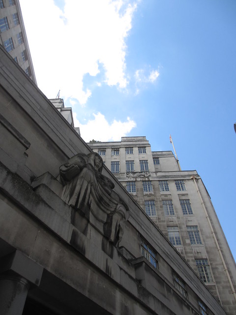
So this first walk starts at the Post Office at 1 Broadway, which is just opposite New Scotland Yard. Going down Broadway away from Victoria Street, we reach our first stop, 55 Broadway. Walk down the Broadway side of the building to see the foundation stone and then go inside the station to the ticket hall.
Stop 1 : 55 Broadway
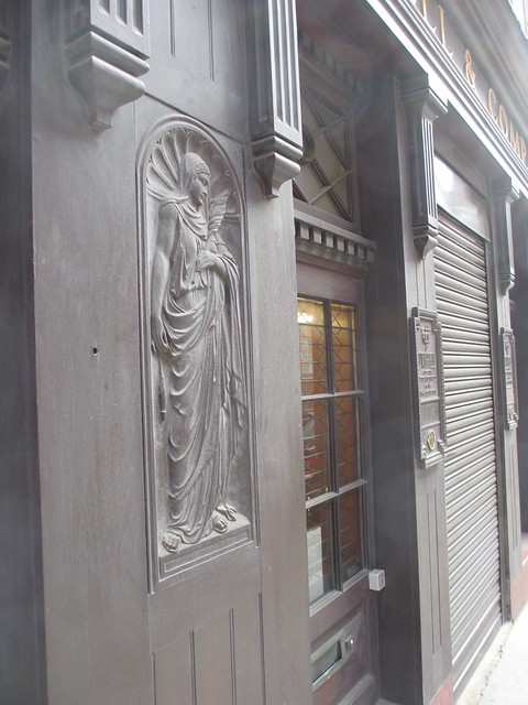
55 Broadway is the historic home of London Transport but it was actually built by its main predecessor Underground Electric Railway Company of London over St James’s Park Station. It is what architectural historian Pevsner calls a “bold building for its date” which is 1927 -1929. It was designed by Charles Holden the architect responsible for many of the iconic Underground stations of the 1920s and 1930s and has reliefs by a number of sculptors including Jacob Epstein, Henry Moore and Eric Gill .
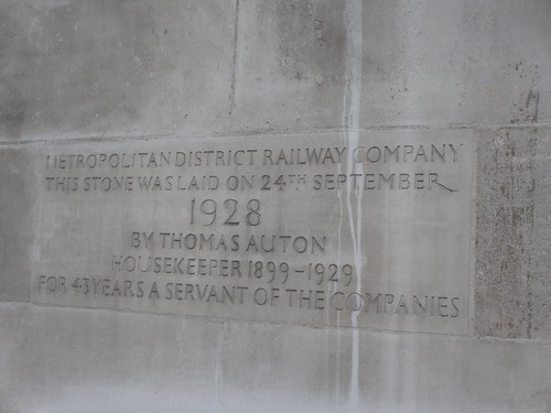
There is a nice touch on the Broadway facade where there is a foundation stone. Interestingly this says “Metropolitan District Railway Company. This stone was laid on 24 September 1928 by Thomas Auton, Housekeeper, 1899 – 1929 for 43 years a servant of the companies.” The Metropolitan District railways was one of the UERL companies and provided the main services through St James’s Park station. Now look at the dates – they must have either altered the date of his housekeeping after the stone was installed or else it was not actually laid on the day it said it was. Intriguing eh?
Another little curiosity at 55 Broadway are the train indicators inside the reception of 55 Broadway just off the station ticket hall. These record on a large paper disc the passing of trains each way at a single point on each of 6 lines (Bakerloo, Central, District, Metropolitan Northern and Piccadilly. There are only 6 lines because I guess the Circle line does not count and this was before part of the Metropolitan became the Hammersmith & City and the Victoria and Jubilee lines were built. Also before the Waterloo & City line was taken over by the Underground.


Come out of the station on the Queen Anne’s Gate side and cross the road going down the right hand side of the modern building ahead
Stop 2: Queen Anne’s Gate
Today stands a massive 1970s block designed by Basil Spence and formerly occupied by the Home Office. I do remember going to meetings there and seeing the various parts of the buildings were split into zones identifed by colour. I particularly liked the “Grey Zone”. Now who said that civil servants have no sense of humour.
This is not the greatest building to look at but there are two interesting things about what preceded this building. First it turns out that Jeremy Bentham lived here

His skeleton can be found fully clothed and with a wax head at University College London. Maybe we will pop in and see him when we get to WC1.
Second this was the site of Queen Anne’s Mansions which was a 14 storey block of flats built in the 1870s.

The height caused some controversy not least because it is said that Queen Victoria could no longer view the Houses of Parliament from Buckingham Palace. The London Building Act 1894 was the response. This limited buildings to 80 feet and remained in place until after the Second World War. This prevented skyscrapers being built in London in the 1920s and 1930s and had a huge influence on how London developed.
Go down Queen Anne’s Gate following the road as it turns right.
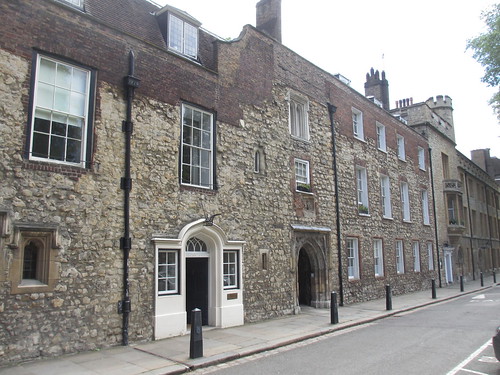
Amazingly there are no less than 6 Blue Plaques in this short but wonderful early 18th century street but I have to confess that I had only heard of one of the illustrious people commemorated – Lord Palmerston, who was born at No 20.
go straight ahead and follow the road as it swerves to the left and becomes Old Queen Street
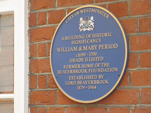
Stop 3: Old Queen Street
Another lovely street. And at No 11 a blue plaque to say this is one of the finest William and Mary Houses from c1690 – 1700. And next door was the home of Richard Savage (4th Earl Rivers) who was Governor of the Tower of London 1660 – 1712. That must have been an interesting commute assuming he actually had to go to the Tower!

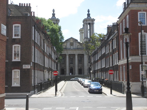
Go to the end of Old Queen Street and turn right down Storey’s Gate. For the purpose of this walk we are going to ignore the big ticket items you will pass (Westminster Abbey, Central Hall Westminster and the QEII Conference Centre) as we have much other interesting things to see! Cross Victoria Street and go through the archway into Dean’s Yard
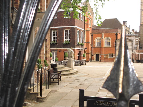
Stop 4: Dean’s Yard
And so we enter the charmed world of Dean’s Yard, just a few steps form the hustle and bustle of Victoria Street and yet you could be in a different city. Maybe a small English Cathedral city. Barchester?
Walking to the left and then turning right you pass Westminster School. It’s private but you can peek through the gate and see in. You can also see by the steps the back of a rather strange look statue. turns out to be the first Queen Elizabeth in celebration of her refounding the school in 1588.
Now go though the gateway and go a little way down Tufton Street, which is straight ahead.
Stop 5: Tufton Street
And here is another little bit of Barchester. Here almost side by side are two ecclesiastical suppliers. Watts & Co and Wippell & Co. Who would have believed that such places still existed in 2013.


Retrace your steps and before the gateway turn right into Great College Street, then turn right into Barton Street.
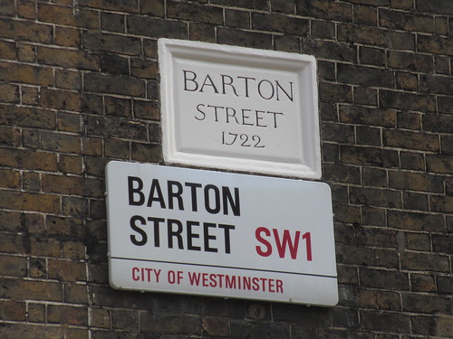
Stop 6: Barton Street
And now a fantastic series of 18th Century streets, starting with Barton Street – where the sign says it dates from 1722. There are two blue plaques at opposite ends of the street and for two very different people. First you come to the one for T E Lawrence (better known as Lawrence of Arabia) at No 14 and then on the other side of the street at No 6 is the one for Lord Reith founding father of the BBC. The plaque itself is confusingly round the corner in Cowley Street. It was have been interesting if these two men had lived in Barton Street at the same time but they did not. Lawrence moving out in 1921 and Reith moving in in 1924.


So we follow Barton Street left round the corner and it becomes Cowley Street, then a little way along you turn again this time to the right. And ahead across Great Peter Street is Lord North Street
Stop 6 Lord North Street
Another lovely 18th century street with wonderful details with St John’s Church framed at the end. And halfway down a little curiosity. A fading painted sign on the wall of Number 8 advertising air raid shelter

Stop 7: Smith Square
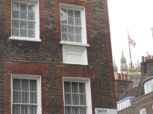
Smith Square is named after Henry Smith who owned land in the area, but it was his father also Henry Smith who provided the site for the centrepiece of the square – St Johns. Built 1713 – 1728 by Thomas Archer severely damaged by enemy action in 1941 and superbly restored as a concert hall in the 1960s.
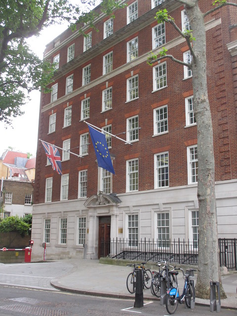
The north side of the Square has the 18th century buildings but the south side is more modern. In the south west corner is a 1950s pretend Georgian office block which used to be Conservative Central Office and is now the European Commission Representative to the UK and the European Parliament’s Information Office. I wonder what Margaret Thatcher would have thought of that!
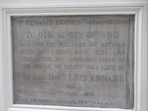
Exit Smith Square using Dean Trench Street which leads to Tufton Street. From here you can do a short detour to the right to see two City of Westminster Green Plaques (Writer Seigfried Sasoon who lived and worked at a house at Number 54 1919 – 1925 and opposite film maker Sir Michael Balcon who lived at No 57A between 1927 and 1939) . Just further up on Tufton Court is a Blue Plaque to Eleanor Rathbone who was a (the?) pioneer of family allowances. Go back down Tufton Street to Horseferry Road, cross and go into St John’s Gardens. But before we cross the road do pause to look at the stone at the corner, which was the foundation stone for Mr Fegan’s house for Orphan Boys laid 20 May 1912. Sounds vaguely sinister!
Stop 8: St John’s Gardens
These gardens were originally the burial ground for St John’s Smith Square, dating from 1731. It soon became hopelessly overcrowded in the 18th century but was not formally closed until 1853. It was converted to a garden in the 1880s and now provides a welcome bit of green space in this area. On the left side is the old Westminster Hospital and on the right side (visible in the picture) is the old Nurses Home – now both converted in the expensive flats.

Around the sides are various tombstones, mostly so weatherworn as to be unreadable. There is even one set into the small building on the Page Street side – on the righthand end. It too is almost completely unreadable apart from the word “illegible”!

Leave St John’s Gardens on the opposite side you came in. And then have a look at Neville House.
Stop 9: Neville House – Page Street (East)
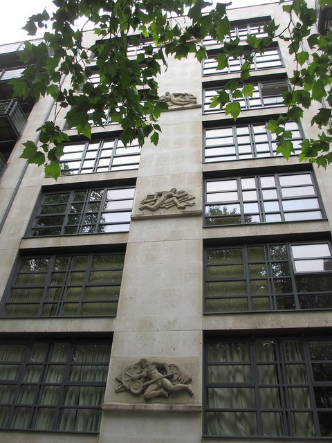
Neville House is an early 21st century residential block now. But it replaced an office block of the same name which had been built in 1937. It was one of a number of 1930s offices building hereabouts in the same style, chunky brick facade with horizontal metal framed windows The others included Abel house, Clelland House and I think also Great Westminster House at the corner of Marsham Street and Horseferry Road. The first two were refaced in 1985. The latter housed the Ministry of Agriculture, Fisheries and Food. It was demolished and replaced by Great Minster House (sic) built 1988 – 1992. I guess Great Westminster House was too much of a mouthful so the name got shortened. Back to Neville House, this was unusual for an office block because it had a pub on the ground floor, the vaguely deco Paviours Arms. This all went with the redevelopment but at least the friezes from along Neville House was saved although now they go up the building rather than along.

Now continue along Page Street, crossing Marsham Street.
Stop 10: Grosvenor Estate – Page Street (west)
Now whilst all the new residential developments, be they new or converted, hereabouts tend to be top end, there is some housing for ordinary folks. We do not have time to go down to the Millbank Estate which dates from the turn of the 20th Century and is very Arts and Crafts. But we can see a housing development by Westminster City Council from the early 1930s – rather incredibly this was by Lutyens. Not exactly known for his council housing. They are in U shape blocks around courtyards and at the open end of the U there are in most places some little pavilion like buildings, which would have provided the estate with shops – a few are still used as shops. A quite surprising find in the backsteets of Westminster.


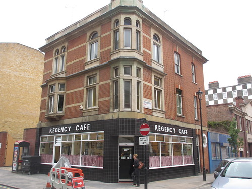
Walking along Page Street, we reach Regency Street, just in time to have some refreshment at the Regency Cafe on the corner. This may look familiar as it has appeared in lots of films!
So that ends our first walk. We may not have found an ancient City but we have seen some of the best bits of 18th Century London plus some interesting bits from the 20th century.
To return to where we started go right into Regency Street, then left into Horseferry Road. At the mini roundabout carry straight on into Strutton ground, which is another good place for lunch or a snack, but only during the week. At the end of Strutton Ground, you will see the Broadway ahead of you and the Post Office where we started.
Stop
