SE2: Knee hill-ism

SE2 is Abbey Wood. This postcode is actually the furthest east of the London postcodes. The area cannot be said to have much of interest and this is somewhat of a contrast to the previous postcode SE1. But as ever we will find enough to entertain ourselves.

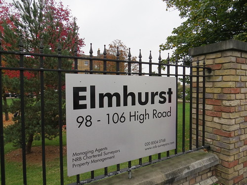
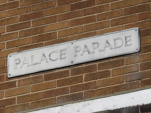
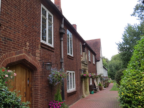
We start our walk at Abbey Wood Post Office, 90 Abbey Wood Road, which is in the heart of what is called “Abbey Wood Village”

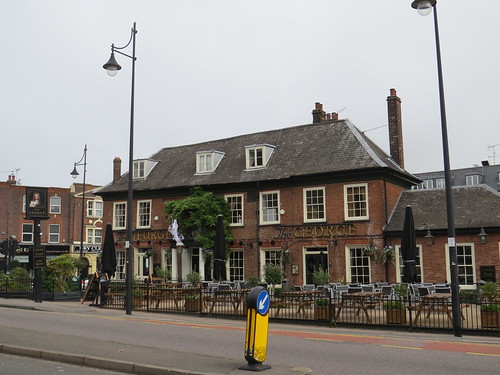
Stop 1: Abbey Wood Village

IMG_0826

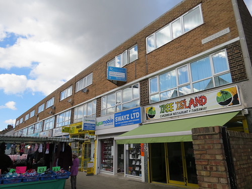
Sadly the reality is a little disappointing. This is not some quaint historic village but a short street of rather nondescript shops. Perhaps the only points worth commenting on is that there seem to be no charity shops and only one empty one. However the selection of shops is somewhat pedestrian.

IMG_0831

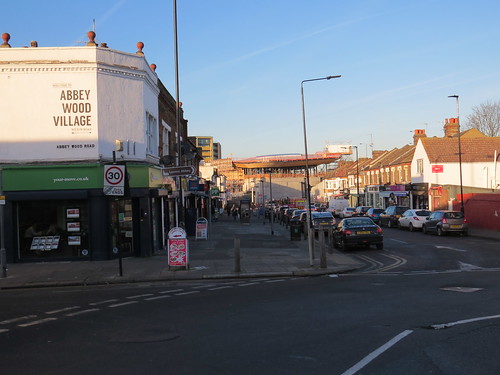
Then there is a dull looking pub – the Abbey Arms – at the end.

IMG_0834

There really is not much to detain us in this “village”. Just beyond the pub is our next stop.

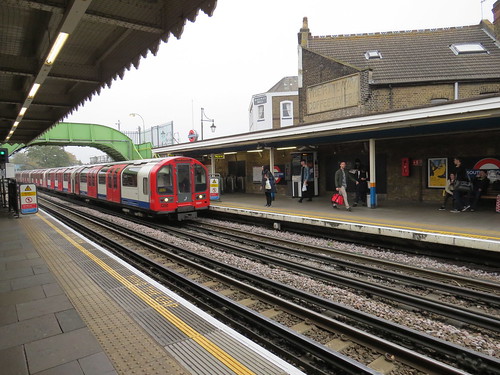
Stop 2: Abbey Wood Station

Abbey Wood railway station was opened in 1849, although there is nothing left to suggest that there was an old station here. It is being rebuilt and will be the end of one of the branches of Crossrail. The new station is emerging and will look quite impressive – it certainly will stand out in this otherwise dull area.

IMG_0720

IMG_0840

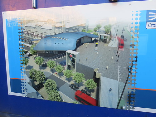
There will be two pairs of platforms by the look of it. On the south side will be the Southeatern services and on the north side will be the new Crossrail services.

IMG_0719

IMG_0715

IMG_0710

IMG_0842

It does not look like they have arranged things so there could be a cross platform interchange with Crossrail. This maybe could have been done if Crossrail lines had been placed in the middle. Thus terminating Crossrail trains could have had a cross platform connection with the Kent bound trains and then they could head out and reverse and go back west from the platform adjacent to the London bound Southeastern services. And if they ever extend Cross rail services into Kent that arrangement would make life easier.

Now retrace you steps back through the “village” and turn left by the Post Office and go under the flyover. This is called Abbey Road and goes under a road called Harrow Manorway.

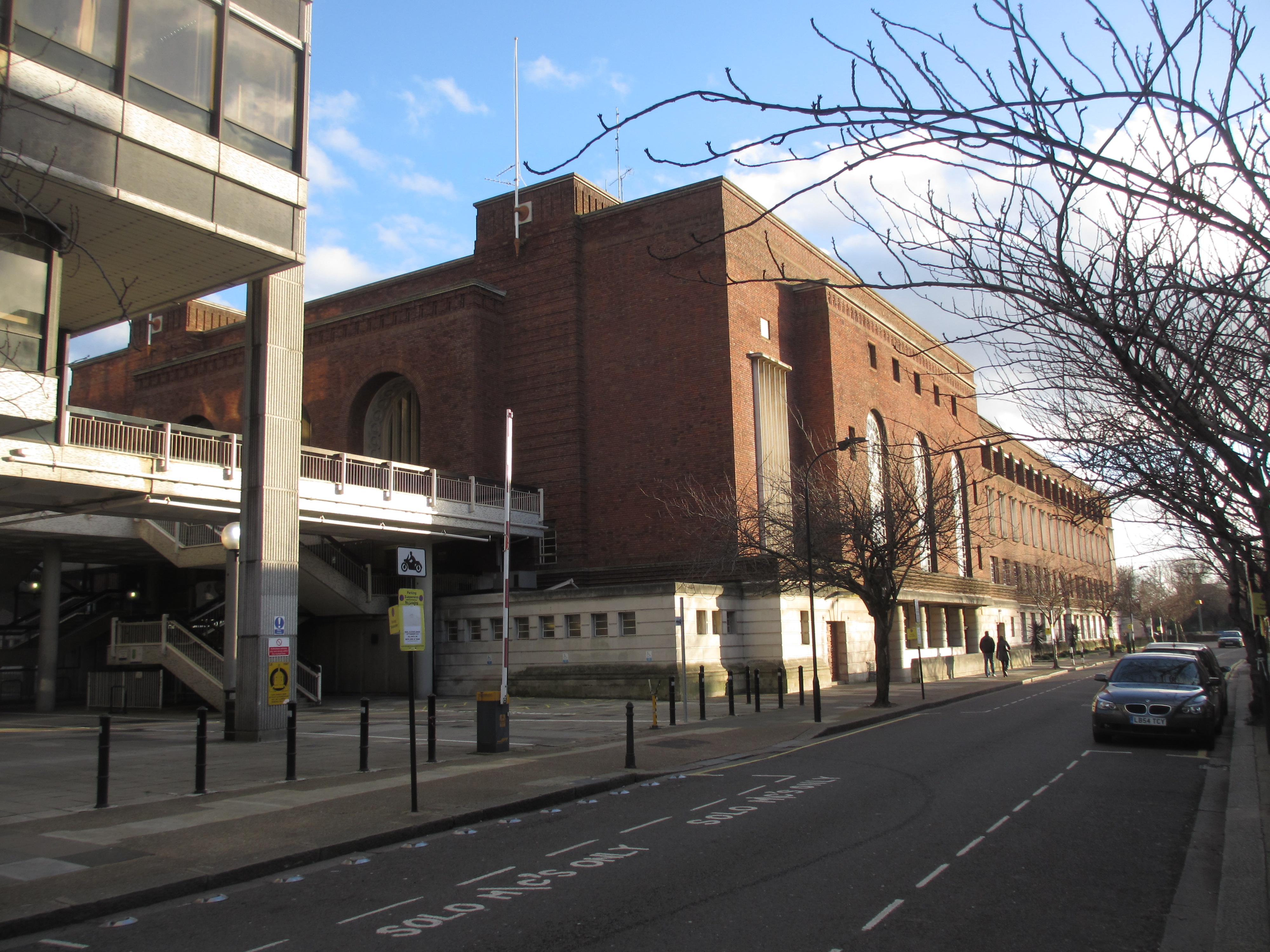
Stop 3: Harrow Manorway

I pause here because this massive flyover and car park beneath seems quite out of keeping with the area.

IMG_0723

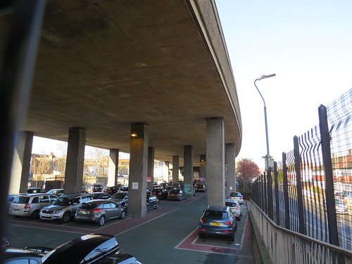
The flyover carries a road called Harrow Manorway and was built in the 1960s to replace a level crossing when nearby Thamesmead was being developed. Here is a view from above, should you be interested. It feels like it should have been part of a bigger road scheme but it just ends here in Abbey Wood.

IMG_0779

Keep walking along Abbey Road. We are heading for Lesnes Abbey.  Lesnes Abbey of course is how the Abbey part of Abbey Wood came about.

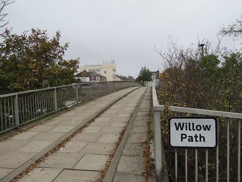
Ignore the sign pointing to Lesnes Abbey which sends you up New Road. Instead keep going and you will an open space on you left. Ahead is a concrete bridge over the road. This carries the Green Chain walk – a linked system of open spaces between the River Thames and Crystal Palace Park in South East London.

IMG_0729

It is here you should leave Abbey Road, by climbing the steps and onto the path leading to our next stop.

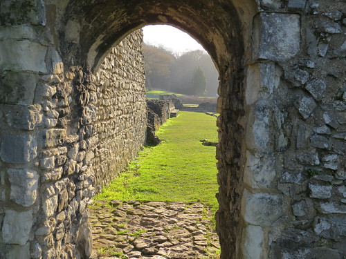
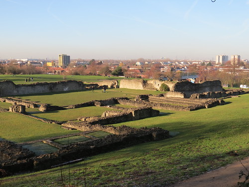
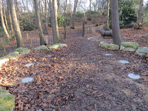
Stop 4: Lesnes Abbey

This open space contains the ruins of a 12th century Abbey – the Abbey of St Mary and St Thomas the Martyr founded in 1178 by Richard de Luci (or Lucy)

IMG_0736

IMG_0766

According to Bexley Council’s website: “De Luci, who had supported Henry II in his dispute with Thomas Becket, which ended with Becket’s murder in Canterbury Cathedral in 1170, probably founded [the Abbey] as an act of penance.”

“Lesnes was not a large or wealthy foundation. Throughout much of its existence, the abbey was in financial difficulties. This was partly caused by the expense of maintaining the river walls and draining the marshes along the banks of the Thames. This reclamation helped transform the land from unusable marsh to valuable pasture. Nevertheless, the abbey gradually built up debts and through the fourteenth century its buildings fell into neglect.”

It never became a large community, and was closed by Cardinal Wolsey in 1525, under a licence to suppress monasteries of less than seven inmates. Lesnes, with only an abbot and five canons, became one of the first monasteries to be suppressed in England. Most of the monastic buildings were pulled down soon after the dissolution, Henry Cooke, who acquired the site in 1541, retained the Abbot’s Lodging for the manor of Lesnes.

It eventually passed to Sir John Hippersley who having salvaged building materials, sold the property to Thomas Hawes of London in 1632. It was then bequeathed to Christ’s Hospital in 1633. They kept it until 1930, when the London County Council purchased it. In 1931 Lesnes Abbey was opened to the public as a park. Ownership transferred to the London Borough of Bexley in 1986.

More info at: http://www.bexley.gov.uk/article/3907/Lesnes-Abbey-ruins

There are a few things to explore here.

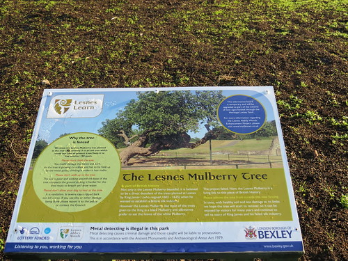
Go up to the left and you will see an old Mulberry Tree.

IMG_0735

The sign says this was part of a failed attempt during the reign of King James I in the early 17th century to create home grown silk.

IMG_0734

And beyond that is a viewing area.

IMG_0750

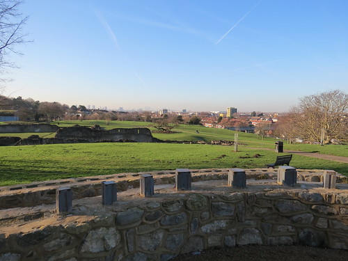
There are plans to provide signage about the park’s history and the landscape beyond and  there is going to be what is called “interpretive abbey windows” to “help to help frame to views across Thamesmead, Woolwich, Dagenham and all the way to central and south east London.” There are just the stubs where the “window” will stand but in the distance you can just about make out the towers of Canary Wharf.

IMG_0756

In the woods behind, there is a “fossil wood” with a rather splendid carved beast of some kind.

IMG_0759

A bit of investigating suggests this is a “Coryphodon” (there is more info about this kind of prehistoric beast on wikipedia if you are interested!  https://en.wikipedia.org/wiki/Coryphodon )

IMG_0763

I could not see any actual fossils (but maybe I was not looking properly) but they did have some plaques which indications of the kind of fossils I guess were found hereabouts.

IMG_0760

It seems you are sort of free to go rummaging round here to look for fossils – subject to certain rules:

http://www.bexley.gov.uk/article/3912/Fossil-bed

Return back to the ruins, which are worth a little wander round. Within the ruins are some signs to indicate what the various areas were used for.

IMG_0737

IMG_0739

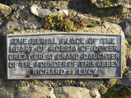
Bexley’s website says: “Rosesia was the great granddaughter of Sir Richard de Lucy, and as a young girl she was raised at Lesnes Abbey… She eventually married and moved away, becoming Roesia de Dover. However, when she died her heart was buried at Lesnes Abbey as a relic to be prayed for in order to speed the passage of her soul through purgatory.”

Beyond the main ruins is an enclosed area which is called the Monk’s Garden, which is being developed with plants typical of when this was a religious establishment.

IMG_0744

Now head off towards the new structure with the green roof, which was shut up on my visit but is supposedly a visitor centre of some kind.

IMG_0768

Keeping this building to your right leave the open space and turn right into New Road. Go down New Road to the end and turn left back along Abbey Road. Just before the flyover, turn left into Manorside Close and go along the little path head which takes you up to the roundabout where Harrow Manorway meets Knee Hill, which is our next stop.
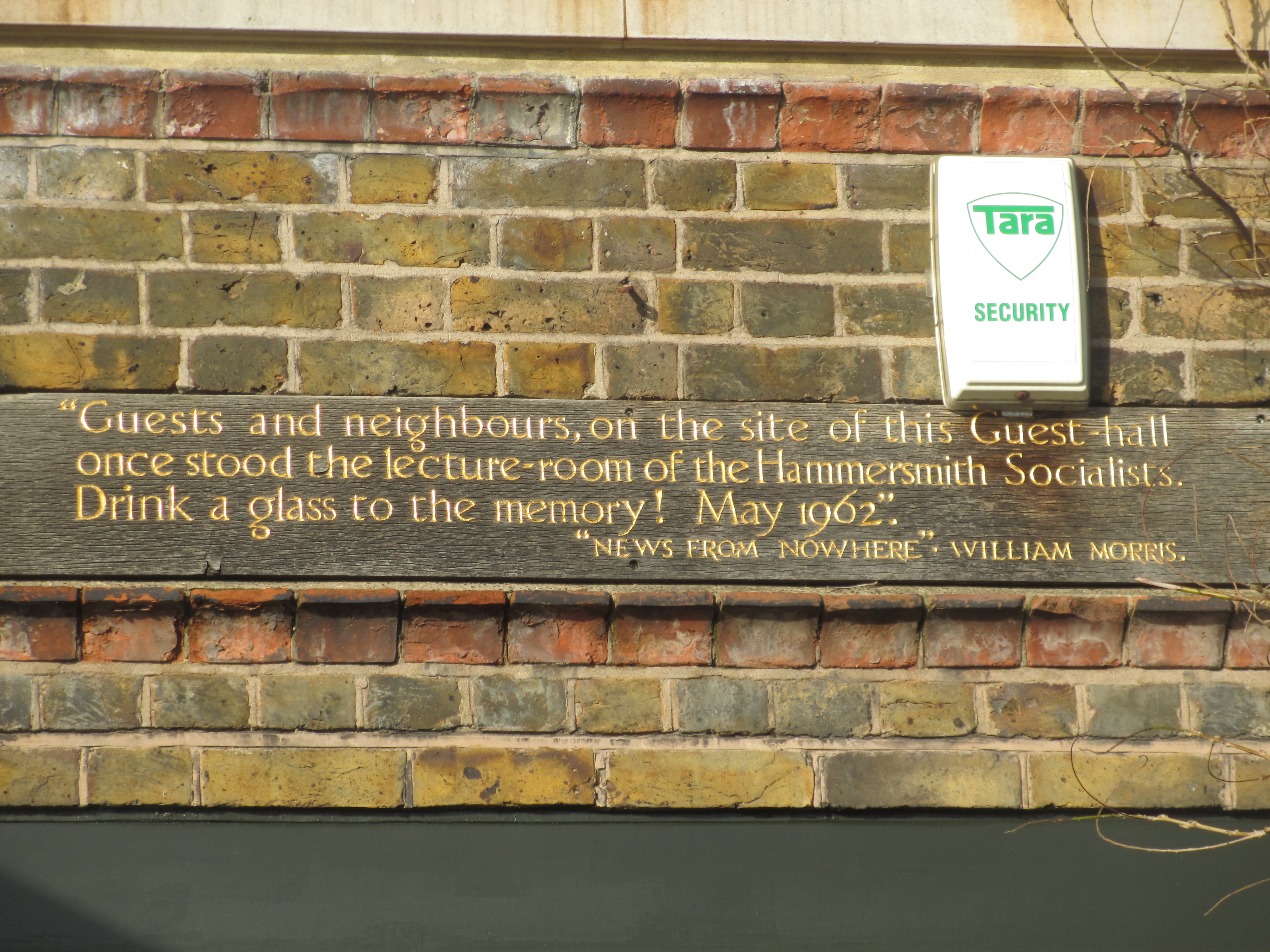
Stop 5: Knee Hill

Head up the street called Knee Hill but look out over the open space to your left,

IMG_0780

You will see a stone plaque (almost opposite the end of Federation Road)

IMG_0788

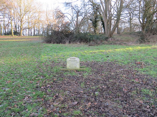
This commemorates a connection with William Morris who lived at the nearby Red House, in Bexleyheath from its completion in 1860 until 1865. Morris regularly walked to Abbey Wood station. He also used a decorated wagon to  travel between Abbey Wood station and Red House, Bexleyheath. Clearly this area was then poorly served by train. In fact the line through Bexleyheath (which today provides a nearer station to Red House) only opened in 1895.

IMG_0787

By the way “Si je puis” (If I can, in English) was Morris’s motto and can be found in a tile in the porch at Red House.

This, it seems, is the nearest Abbey Wood can get to a blue plaque – and it is not even blue and it only commemorates that someone famous passed by!

Now the name of this place brought to mind that it sounded like it might have something to do with nihilism. In philosophy nihilism is: “the belief that nothing in the world has a real existence.”. Perhaps this is kind of fitting for SE2 which is a kind of uninspiring non-place where the only thing which is deemed worth remembering is something so fleeting that it hardly had any real existence.

Now back in the “real” world, take a right into Federation Road.

Stop 6: Caravan Club

Just along here on the left is a surprising sight – a camping and caravan site which is owned and operated by The Caravan Club.

IMG_0791

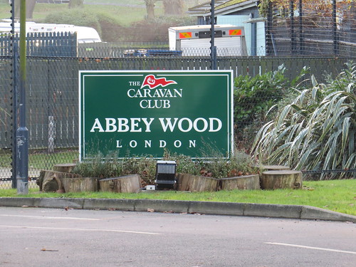
The Club was founded in 1907 as The Caravan Club of Great Britain and Ireland. Its aim was to “… bring together those interested in van life as a pastime…to improve and supply suitable vans and other appliances…to develop the pastime by collecting, publishing and supplying to members, books and periodicals and lists of camp sites etc… to arrange camping grounds.” Now known simply as the Caravan Club it runs some 200 sites of which this is one of two in Greater London.

Just seems kind of odd to find a place like this here.

Now keep walking along Federation Road

Stop 7: Co-op Estate

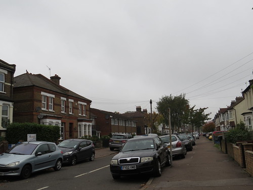
The houses here were developed by the Royal Arsenal Co-operative Society (RACS). They owned two farms in the vicinity of Abbey Wood and created the Bostall Estate between 1900 and 1930. The housing is largely traditional terraced houses in yellow London brick, with gardens to the front and rear. This was apparently also known locally as “The Co-op Estate”

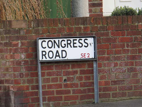
The streets are named after Co-operative themes (Alexander McLeod was the first secretary of the RACS, Rochdale was location of the first modern Co-op, Robert Owen is regarded as the father of the Co-operative movement, plus there are streets called Commonwealth, Congress, Conference and Federation). There were some shops but no public houses to tempt the good people of the estate.

IMG_0789

IMG_0821

IMG_0796

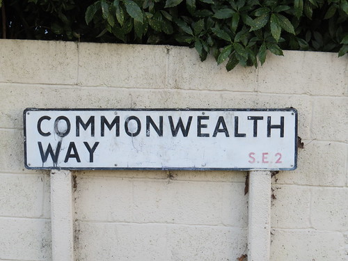
By the way I gather snooker champion Steve Davis lived in Commonwealth Way (don’t know exactly where) and went to Alexander McLeod Primary School and Abbey Wood Secondary School.

In the late 1950s the London County Council built the Abbey Estate starting with one road south of the railway and later extending on the northern side on former RACS marshland. The later in the mid-1960s the Greater London Council began building the first phase of Thamesmead on more ex-RACS land, north-east of Abbey Wood station. But that is now in SE28, so we will have to save that for a future date.

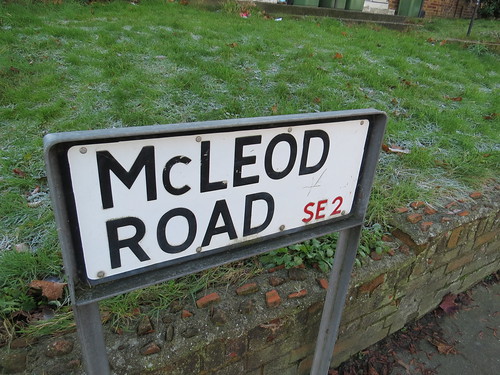
Now take a right down Shieldhall Street and ahead on the other side of McLeod Road is our next stop.

Stop 8: Greening Street Green

My eye was drawn to the open space ahead which is known as Greening Street Green.

IMG_0804

IMG_0807

It is a sad space imprisoned in a high wire mesh fence. Not at all inviting. It is almost as if the Council want to stop people using this. No doubt in the past it seemed a good idea to have this high fence stop balls escaping and dogs entering. But it really could be done better.

At the end of Shieldhall Street, I found our next stop.

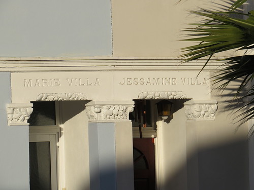
Stop 9: Numbers 71 – 81 Abbey Wood Road

Facing on to Shieldhall Street and Greening Street are six terraced houses with names. They have the delusion of grandeur in that they are all “villas” despite being quite modest terraced houses.

IMG_0817

Starting on the left there is Stanley and Eric.

IMG_0808

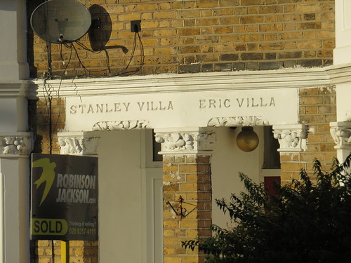
And then there is Marie and Jessamine.

IMG_0809

And finally Hyacinth and Myrtle.

IMG_0813

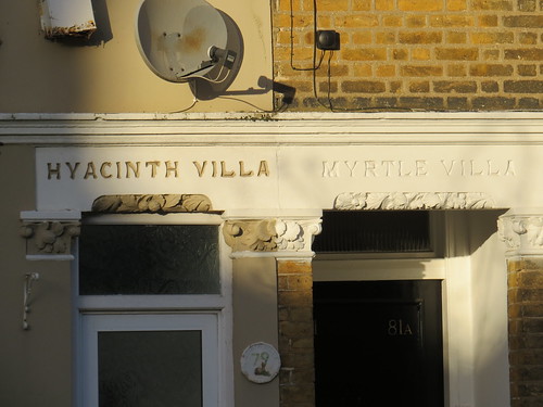
Presumably these were relatives (or maybe friends) of the developer or builder. These people may have been so proud or honoured to have a house named after them. Their names live on it over the doorways of these six houses but who they were and why their names were chosen is I guess lost in the mists of time.

Walk along Abbey Wood Road as if you had done a right out of Shieldhall Street. Our next stop is ahead on the left

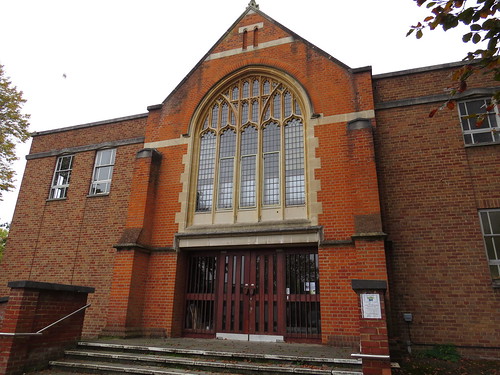
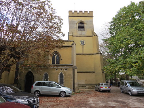
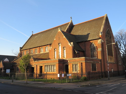
Stop 10: St Michael and All Angels Church

Architectural expert Pevsner normally so effusive in the description of churches simply mentions the existence of this one.

IMG_0820

IMG_0822

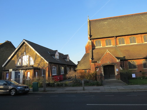
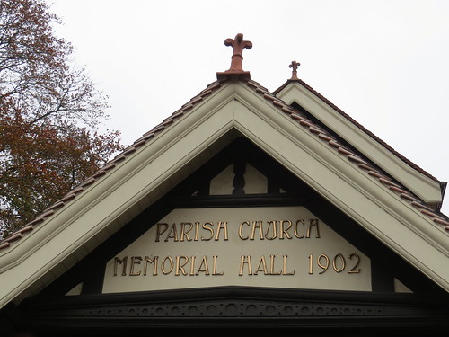
St. Michael and All Angels Parish Church opened in a temporary building in 1905. The permanent church, designed by well known church architect Sir Arthur Blomfield, was consecrated in 1908, and the original building became the church hall, which can be seen at the western end of the church…

Unusually for a church of this period the foundation stone is modest in the extreme.

IMG_0824

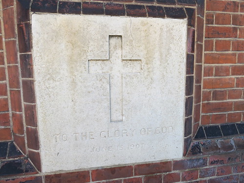
It does not even have a name, just saying “To the Glory of God June 15 1907”.

So that brings us to the end of our SE2 walk – well sort of.

Postscript

There is one thing which is really worth a visit in SE2 but it is a little too far to go to. That is the Crossness Pumping Station – a piece of wonderful Victorian engineering which was a key part of the sewage system created by Sir Joseph Bazelgette (1819 – 1891) in the 1860s.

Crossness is at the eastern end of the Southern Outfall Sewer and the facility included storage tanks and an engine to pump out the sewage on the falling tide.

IMG_0773

The Beam Engine House is a Grade 1 Listed Industrial Building constructed in the Romanesque style and features some spectacular ornamental Victorian cast ironwork. Today the Engine House is open for visits but the times are limited. See attached link:

http://www.crossness.org.uk/visit.html

A word of warning – according to TfL Journey Planner, the nearest bus stop to the Crossness site is some 28 minutes walk away. So probably best to use your own transport if you want to visit.

Well that really brings us to the end of our SE2 walk. Not the most inspiring postcode but even so it had the remains of a medieval abbey and a reminder that William Morris passed through here on the way to his house.

Assuming you did not go to Crossness you will see that you are virtually back to Abbey Wood station for onward travel.


E18: By wisdom and courage

E18 is Woodford – or more accurately South Woodford, because Woodford itself is actually in an IG postcode. It is quite a small postcode and one which seems completely devoid of blue plaques, though there is one famous connection with a non-blue plaque.

I am grateful to fellow guide and local resident Debbie for giving me the low down on South Woodford, which was great as I found precious little to go on.

I was also stumped as to what to call this walk until I found out that the motto of the former Wanstead and Woodford Urban District Council was “Consilio et Animo”. That translates as “By wisdom and courage”. With that in mind, let us venture into E18.

We start our walk at the Post Office at Number 139 George Lane. Go down Glebelands Avenue which is almost opposite the Post Office. At the end, cross over the High Road and into Bressey Grove.

At the junction of Byron Avenue, you will see an alley to the right. Go down there but just before you do look down Byron Avenue.

IMG_0098

Debbie assures me that on a clear day you can see Canary Wharf! Sadly I did not see it when I was there.

Go down the alley way and ahead you will see a bridge with a sign saying Willow Path.

IMG_0100

This is to lull you into a false sense of being in a bucolic country scene, when it fact you are about to cross over 10 lanes of roaring traffic.

IMG_0102

This is the North Circular Road with the slip roads going up to Waterworks Corner.

Once over the bridge, turn right and go along Grove Road.

Stop 1: Church End Estate

IMG_0109

The roads just here all have a connection.

Going north – south, we have: Peel Road; Walpole Road; Carnarvon Road; Stanley Road; Malmesbury Road and Buckingham Road.

And east – west, we have: Chelmsford Road and Derby Road

This is like that part of the Only Connect quiz where you have to make the connection between seemingly random clues. We have some prime ministers (Peel, Walpole, Derby); we have some earls (Derby, Malmesbury, Carnarvon) and we have some places (Carnarvon, Malmesbury, Buckingham, Chelmsford, Derby). But none of these link all the names.

Debbie gave me a clue when she said they were all 19th century cabinet Ministers. So I did a little research and as far as I can establish the only time these men (and they are all men) were in the Cabinet at the same time was between June 1866 and March 1867, as follows:

Earl of Derby (PM); Lord Chelmsford (Lord Chancellor); Duke of Buckingham (Lord President); Earl of Malmesbury (Lord Privy Seal); Spencer Walpole (Home Secretary); Earl of Carnarvon (SoS for the Colonies); Lord Stanley (Foreign Secretary) and General Jonathan Peel (SoS for War).

Note the Walpole and the Peel, are not the famous ones – Sir Robert Walpole who was Prime Minister in the 18th century or Sir Robert Peel who was Prime Minister in the 1830s and 1840s.

It is surprising that the estate agents haven’t christened the area something like “The Ministers” or the “Cabinet estate”. But interestingly this area does seem to have a name which is hinted at on a number of benches which are placed along Grove Road. Here you can sit and hear the drone of the North Circular Road.

IMG_0107

IMG_0112

Debbie uncovered an article on the internet which indicates that the A.C.E. in A.C.E. Residents Association stands for Action on Church End because this area is known as the Church End estate.

http://www.ilfordrecorder.co.uk/news/politics/former_residents_association_treasuer_reacts_angrily_to_request_from_redbridge_council_to_release_funds_1_2015492

The article dating from 11 April 2013 suggests that the ACE Residents Association has folded up.

Go along Grove Road and turn left into Buckingham Road.

One other thing I noticed was that unusually for a London postcode area, the street signs do not include the postcode. Most look like this.

IMG_0115

But I did find one that admitted we were in an E postcode area.

IMG_0114

Looking closely I this may have been added unofficially. Perhaps the powers that be wanted to pretend this area was in Essex like Woodford just up the road (but like South Woodford, Woodford is also in the London Borough of Redbridge).

At the end of Buckingham Road turn right and go to the end where you will turn right again. this is the High Road and our next stop is almost immediately on the right.

Stop 2: Parish Church Memorial Hall

IMG_0127

This quite nice building has the date 1902 on the front.

IMG_0117

And there is a sweet little foundation stone to the left of the door.

IMG_0121

But perhaps the most interesting thing is mentioned on another plaque at the front. This says that “William Morris lived at Woodford Hall 1840 – 1847. The House demolished in 1900 stood to the rear of this site.”. This seems to be the nearest South Woodford gets to having a blue plaque.

IMG_0116

The artist, designer and social activist, William Morris lived here from age 6 until he was 13 or so. The family moved to a smaller house after his father died in 1847. That is the house in E17 which now the William Morris Gallery.

Our next stop is right next door.

Stop 3: St Mary’s Church

This is an odd looking church.

IMG_0130

It looks very unlike a Church of England parish church, more like a non conformist place of worship.

IMG_0156

Architectural guru, Pevsner says the entrance dates from 1888 but was rebuilt after a fire in 1969, But what is even odder is that this entrance is at the east end of the building.

The church itself is a strange mix of ancient and modern.

IMG_0153

But there is an interesting tower at the western end, which Pevsner describes as “a sturdy brick tower, 1708, with broad corner buttresses rising to stumpy polygonal pinnacles. (these and the parapet rebuilt 1899).”

IMG_0152

Behind the church to the right is a marble column which was put up in memory of a man called Peter Godfrey who died in 1769.

IMG_0145

And by the wall is a grand tomb, the Raikes Mausoleum, first used from the burial of Martha Raikes who died in 1797.

IMG_0150

Now Pevsner suggests that Sir John Soane came here in 1800 and sketched this tomb. He later used a similar shape for his own family mausoleum in St Pancras’ Old Churchyard. And this in turn was said to be the inspiration for Giles Gilbert Scott’s design for the iconic red telephone box of the 1930s.

Returning to the front have a look at the rather prominent tomb on the green.

IMG_0131

This turns out to be the tomb of none other than William Morris’ parents – William and Emma.

IMG_0133

Walk along the High Road crossing over. Our next stop is just outside the modern library.

Stop 4: Some odd artwork

Here we have a seat with lots of little panels with snippets of the history of Woodford.

IMG_0161

IMG_0162

One of the panels explains that “This bench has been created to celebrate the history of Woodford with photographs … London Borough of Redbridge commissioned artist Tim Ward of Circling the Square to design this bench which was installed in 2012.

IMG_0163

It is a nice idea but I do not think it really works. If you sit on it, you have to twist around to see anything. It is particularly hard to see many of the pictures, especially the ones inside the ring of the seat. So whilst it looks nice enough what was the point of going to all this trouble of researching and reproducing all these pictures when no one is likely to appreciate them..

Stop 5: Elmhurst

Keep walking along the High Road and our next stop is soon on the left. It is one of several 18th mansions which have survived along the High Road.

IMG_0167

IMG_0168

It was converted to be a hostel for Queen Mary College in 1926 and subsequently the land behind was developed for student accommodation. This has since been redeveloped as we shall see, but the house remains, as a commercial building with a branch of the pizza chain Prezzo tucks in at the right hand end.

Now look ahead and over the road for our next stop.

Stop 6: Some more odd artwork

IMG_0171

According to Redbridge Council’s website: http://www2.redbridge.gov.uk/cms/leisure_and_libraries/leisure_and_culture/arts_culture_theatre/arts_events_and_activities/public_art/south_woodford_public_art.aspx#sthash.6VHPwW0O.dpuf

“Lucien Simon was commissioned to produce three sculptures for the bridge over the A406 in South Woodford which were installed in February 2012. The programme also included benches and decorative paving by artist Tim Ward and the addition of new planters with silver birch trees.

The three sculptures were designed to bring a contemporary take on the natural world into a predominantly urban landscape and to reflect the historical context of South Woodford as a rural and semi-wooded area and the proximity of Epping Forest, a still magnificent area of ancient woodland and London’s largest open space.

The structures are just over 7 metres high, and fabricated from stainless steel with leaf shapes laser cut into the fabric and lighting within the columns and at a stacked glass section between the column and the leaves at the top of the sculpture. The columns are of a sinuous, natural shape to emphasise the organic inspiration behind the installation. Local school students worked with the artist to come up with the leaf shapes so that there was strong community involvement in the project.

The project was funded by Telford homes as a condition for the nearby Queen Mary’s Gate development, meaning that the money could only be spent on public art and related works within the area.”

I guess the circular bench we saw earlier was also part of this commission

It is an attempt to brighten up an otherwise dull street scene. But really who is going to linger here given you are sitting atop 10 lanes of roaring traffic. (By the way the Queen Mary’s gate development is the one you can see from the bridge looking back towards Elmhurst. This is the redevelopment of the site used by Queen Mary College)

IMG_0181

You will see as you pass over the bridge, there is a Waitrose supermarket to the left. go down here.

Stop 7: Waitrose, South Woodford

IMG_0184

Now if you look to the right end of the supermarket you will see there is an old building, on to which the new supermarket appears to have been grafted.

IMG_0187

This is Grove Lodge, an 1835 gothic style villa. Pevsner comments: “It deserves a better setting”. Maybe but at least it is still here, serving in part as Waitrose’s cafe.

Continue along the High Road. our next stop is at the corner of George Lane on your left.

Stop 8: Electric Parade

IMG_0195

IMG_0191

This parade of shops dates from 1925 and when built must have been a very visible indicator of the creeping urbanisation here. Debbie says the name denoted the arrival of electricity to the area.

Our next stop is on the opposite corner of George Lane.

Stop 9: The George

IMG_0199

This rather lovely pub is probably early 18th century in origin with some later additions. The name therefore makes sense as this was the time of the Hanoverian kings who were called George.

It is in fact slightly overshadowed by our next stop which is just next door.

IMG_0197

Stop 10: Odeon Cinema

This working cinema opened as the Majestic Theatre in November 1934. According to the wonderful Cinema Treasures site, it was the last to be built of a small independent chain of five Majestic Theatres built in the outer London suburbs and the South East of England.

The opening was presided over by Winston Churchill who at that time was the local Member of Parliament.

The Majestic Theatre was taken over by Associated British Cinemas (ABC) in August 1935. It became the ABC and was later split into three cinemas. In 1986 it was renamed Cannon and later Odeon. Further screens have been added so it now has seven.

It is nice to see an old cinema still in use. But the outside is looking a little sad and I doubt there is much of the 1930s interior left inside.

You will see a little alley just beyond the Odeon. Go down this and it will take you to our next stop.

Stop 11: Sainsbury’s South Woodford

This is a none too special supermarket today.

IMG_0210

But it was actually built on the site of South Woodford’s other cinema. the Plaza. According to the Cinema Treasures site, the first cinema in this site was called the South Woodford Cinema in 1913 with a seating capacity for 601. It was closed in 1934, to be enlarged and modified in an Art Deco style. It reopened as the 1,600 seat Plaza Cinema in September 1934. In other words just before the Majestic opened.

It always seems to have been independently owned and operated. It finally closed in May 1977. The building was demolished and a Sainsburys supermarket was built on the site.

But they did at least put some reminders of old South Woodford here on some panels, including one about the Plaza.

IMG_0211

Interesting the dates on the sign (opening 1932 and closing 1978) are different from the usually reliable Cinema Treasures site.

But really Sainsbury’s. Did you have to put the trolley shelter in front of these panels. Typical insensitivity of a major retail chain.

IMG_0208

There is some other interesting stuff about the locality including a mention of suffragette Sylvia Pankhurst, even she was mainly connected with Woodford proper. (She is also mentioned on the bench on the bridge).

IMG_0214

If you keep going down the side of the supermarket you will end up on George Lane. turn right and this will take you to South Woodford station

Stop 12: South Woodford Station

There has been a station here since 1856.

IMG_0088

And originally there was a level crossing by the station. This was replaced by an overbridge a little up the track when the line was rebuilt to become part of the Central Line in the late 1940s.

IMG_0084

IMG_0082

But today the buildings of the station are later. There is an 1880s building on the London bound platform and the ticket hall building on the Epping bound side dates from 1910. There are some further additions from the late 1940s. It looks like the canopies over the platforms were extended at this period.

On the far side of the tracks is an odd survival of a sign on the wall of a building

IMG_0081

This is for the Railway Coffee House, no doubt this was meant to tempt people away from the Railway Bell pub over the road. Sadly today there is no sign of the Coffee Tavern on the road side of this building now – not even a modern day Coffee shop.

And finally there is one little quirk to the station and that is its name.

IMG_0080

It has “George Lane” in brackets after South Woodford. As far as I can determine there was only ever one station at South Woodford so there was no chance of confusion. The name change actually happened in 1937 before the Underground took over, but the full name was taken forward when the Central Line was opened.

But why? The Central Line eastern extension had a station at Bethnal Green where there was a nearby station of the same name but no attempt to differentiate the two. Indeed for many years there were two quite separate station with the name Shepherds Bush, one of which was on the Central Line. So it really is a mystery why it was felt necessary to have George Lane in the station name here.

Well that brings us to the end of our E18 walk. Thanks to Debbie for showing me round and helping to ferret out some interesting stuff about this relatively quiet edge of East London.

E17: Awesomestow – or going to the dogs?

E17 is Walthamstow – end of the Victoria line, once home to a dog racing track and artist Grayson Perry’s studios and the place that gave its name to a pop group. In exploring E17, I am indebted to fellow guide, Jo Moncrieff for sharing her notes about Walthamstow.

We start our walk at the Post Office at Number 48 High Street (the one at the western end of the High Street). turn right out of the Post Office and walk along the High Street, which usually has a lively selection of market stalls, selling all sorts of stuff.

Apparently this is the longest street market in Europe at over 1km and it has been around since the 1880s.

Our first stop is at number 76, High Street.

Stop 1: L Manze’s Pie and Mash Shop

This is one of those amazing survivals.

IMG_9737

The plaque outside explains that the Manze family were originally from Ravello in Italy and came to England in 1878. they founded an empire of 14 pie and mash shops,. This particular one was rebuilt in 1929.

IMG_9736

According to an article I found (Daily Mail dated 30 October 2013):

“The Manze family ran the east London eatery until 1970 before it came into the hands of current owner Jacqueline Cooper.”

Apparently David Beckham’s love of the dish has made it trendy again, the owner says.

Read more: http://www.dailymail.co.uk/news/article-2480460/Pie-mash-shop-L-Manze-opened-1929-given-Grade-II-listing.html#ixzz4OaTloS5W

There are some other shops with the Manze name elsewhere in London but they are separate businesses from this one.

As I was here, I had to go in and sample the pie and mash.

IMG_9740

To be honest this is not the greatest food. It is bland and with little texture. I prefer to have a meat pie where there are visible lumps of meat rather than this style where the meat has been ground into tiny globules.

I am reminded of the advice given by Mrs Lovatt in Sondheim’s version of Sweeney Todd where she is telling the lad Toby how to grind the “meat” for the pies. She explains that the secret for making the pies so juicy is to grind the meat three times. I think it is entirely possible that the meat in Manze’s pies may have been ground a few more times than that.

I did take some pictures of the interior which is lovely, even if the seats are clearly not designed to make you linger. There were quite a few other customers in at the time, but they just cannot be seen!

IMG_9742

IMG_9744

The shop advertises eels but all the customers I saw were eating pie and mash with the green specked liquor.

Now continue along the High Street. Our next stop is a little way along the High Street.

Stop 2: Palace Parade (site of Palace Theatre)

Heading along the High Street our next stop is on the left almost opposite the indoor shopping mall. There is a row of shops which have the name Palace Parade.

IMG_9732

And it is that name that gives away what was once on this site.

IMG_9731

This was the location of the Walthamstow Palace, a music hall/variety theatre which opened at the end of December 1903. The Palace was designed by Oswald Cane Wylson and Charles Long who also designed the Palaces at Chelsea, East Ham, Euston and Tottenham. Only the last of these has survived, as we saw when in N17.

For most of its life, it mainly presented variety shows. It finally closed in February 1954 and was soon left abandoned, becoming derelict. It was demolished in 1960, to replaced by this parade of shops with flats above.

Stop 3: the “Awesomestow” sign

Now go into the shopping mall, which goes by the oh so original name of “The Mall”.

IMG_9761

The Mall is not particularly interesting – the only surprise is that there is a branch of Waterstone’s in amongst the “economy” shops. If you get to Waterstone’s look back for our next stop, which is above where you have just walked.

IMG_9766

IMG_9764

This is an attempt to “rebrand” Walthamstow. The fact this neon sign is in such a mall is perhaps not the best way to proclaim the “awesomeness” of Walthamstow. And some people no doubt consider the changes in Walthamstow are not for the best.

Now exit the Mall into a kind of square, turning right into the High Street. Our next stop is across the road.

Stop 4: Empire Cinema

IMG_9774

Here we have a new block of apartments which includes a new multiscreen Empire Cinema and some restaurants. It really does look so continental – not English at all. The free standing sign for the cinema is a nice touch.

IMG_9773

The cinema has 9 screens and opened in November 2014.

Now walk to the end of the High Street and you will see our next stop ahead.

Stop 5: Central Parade

Across the road is a rather splendid post war building, with clock tower. All very 1950s

IMG_9776

I love the wavy canopy facing Hoe Street and then there is this series of crests below the clock.

IMG_9780

And in case you were wondering what the shields represent, there is a little key if you look. (It is between the main door and the shields).

IMG_9782

But I am none the wiser as to the connections to Walthamstow. They do not seem to be twin towns so I guess they are the crests of families which have had connections with the area. One that jumps out is Warner. Sir Courtney Warner (1857 – 1934) was a local landowner, MP and the first Mayor of Walthamstow. He was responsible for developing substantial amounts of housing in  the local area from the 1880s. And from Jo’s notes I guess Maynard might be Sir Henry Maynard. As a result of a bequest of £50 by him, the local workhouse was provided with a brewhouse in 1747 to make it more comfortable!

Earlier this year, the building was converted from council use into what is described as “a mixed use creative hub”, with a variety of retail; workspace and studio space, and bakery cafe. The building will be open for two years whilst the long term future of the site is being decided upon. It would be a terrible shame if the council decide to demolish such a distinctive building.

Now walk a little way along Hoe Street and you will see our next stop.

Stop 6: Former Granada cinema

This was one the site of the Victoria Hall which opened in May 1887 and which was used for dances and concerts. It became a live theatre and eventually a cinema, called the Victoria Picture Theatre . It was purchased by Sydney Bernstein in March 1930, and was immediately demolished to be replaced by a brand new Granada cinema which opened in September 1930.

IMG_9786

It was the second Granada Theatre of what would become a major chain. It was designed by Cecil Masey in a Spanish Moorish style with an interior design was by Russian theatre set designer Theodore Komisarjevsky, who went on the design the interiors of many more Granada cinemas.

IMG_9791

Like many super cinemas of this period, it had stage facilities which were used for things like Christmas Pantomimes and one night pop shows – The Beatles amongst other famous names appeared here, as evidenced on this little blue plaque on the front.

IMG_9793

By the way, look at the originator of this plaque – Street of Blue Plaques. More info on this at: http://www.dannycoope.co.uk/street-of-blue-plaques/

Anyhow back to the Granada story – In October 1973, the cinema was tripled. And it continued as a main stream cinema under various names (Cannon, Virgin, ABC) until about 2000. By then ABC had been taken over by Odeon who closed the cinema. They put a stipulation on any sale of the building, that it could never screen English language films again.

The cinema was purchased by an independent operator, and it was re-named EMD Cinema showing Bollywood films. After a court battle, this operator gained permission to screen regular films again. However the EMD Cinema  closed in January 2003.

The story since then has been complicated – see the wonderful Cinema Treasures site for the details: http://cinematreasures.org/theaters/9397

But the story seems to have moved on. In 2015, Soho Theatre announced it was working with Waltham Forest Cinema Trust and the London Borough of Waltham Forest to create a new comedy, theatre and cinema venue here. The last update on their website is December 2015 so not sure what is happening there.

But the building is starting to be used for entertainment again, as evidenced by the notice boards on the building:

IMG_9794

And this website:

http://mirthmarvelandmaud.com/

If fact, on 31 October 2016, one of the smaller screens was opened for a presentation of Mel Brooks “Young Frankenstein”, the first film to be shown in the cinema for over 13 years.

Hopefully this Grade II* Listed building has a bright future.

Now go back down Hoe Street and turn left by the clock tower into Church Hill. Go along Church Hill until just after the Girls School where you will see a newly laid out mini piazza.

IMG_9799

Turn right here and head towards the church

Stop 7: Monoux Almshouses

Just before the church is a pathway.

IMG_9806

This is called Vinegar Alley and by it are some almshouses.

IMG_9802

IMG_9805

These almshouses were founded along with a school in 1527 by local benefactor, George Monoux who was a city merchant and Lord Mayor of the City of London in 1514/1515. He died in 1544.

(By the way, Jo says that the name is pronounced locally as “Monnocks” not “Monnow”)

The school stayed here for over 350 years. It moved to its present site in Chingford Road in 1927. Famous old boys include choreographer Matthew Bourne, jazz musician Sir John Dankworth and footballer Teddy Sheringham.

The eastern end of the almshouses was almost wholly rebuilt in the late 18th century with the western end remaining untouched until being destroyed by a German bomb in 1940. That was rebuilt in 1955.

Now head past the church, which although medieval was renovated in the late 19th century and again after the Second World War having been damaged by bombing in 1940.

IMG_9807

Just after the church is our next stop.

Stop 8: The Ancient House

IMG_9811

When I saw this I thought: am I actually in Wathamstow? But yes I am. Pevsner says this is “a notably complete timber framed hall house of 15th century.”

Do go down the side street, Orford Road..

IMG_9842

The building is not on a hill and there is a fascinating sign which explains why the side wall looks like it does.

IMG_9829

Whilst here do have a look down this street at the nearby Nag’s Head. According to the notes from Jo the original pub was opposite the Ancient House and the first record of that is from 1673 in connection with the illegal playing of shovelboard and tippling. That pub became unfit so it was demolished.

IMG_9834

The Nags Head was the terminus in the 1850s of a horse bus service operated by the landlord, Francis Wragg. He ran eight times a day to Lea Bridge Station (opened in 1840) for trains to London, there being no railway to Walthamstow for another thirty years. In 1859 the pub was relocated to its present site in Orford Road and a coach house was built alongside. The coach house still stands, but is now residential.

IMG_9839

The horse bus service closed soon after 1870 when the Great Eastern Railway arrived at Walthamstow.

More info at:

http://pubshistory.com/EssexPubs/Walthamstow/nagshead.shtml

The railway passes really close by just beyond the Nags Head. Interestingly the station was not put here near the actual village but a little way to the west, at what is now Walthamstow Central.

Now turn left out of Orford Road.

Stop 9: Vestry House Museum

Our next stop is ahead after the Squires Almshouses. This is the Vestry House Museum.

IMG_9828

IMG_9827

According to Pevsner, this was built by the parish as a workhouse in 1730 and used as such to the 1830s. It became a museum in 1931. There is a stern warning here on a plaque which says “if any should not work neither should he eat”. Unaccountably I failed to take a picture of this!

But I did get a picture of this plaque.

IMG_9826

But outside there is something you can hardly miss.

IMG_9823

This is from the portico of Robert Smirke’s General Post Office in St Martin Le Grand. When the building was being demolished this was purchased by a local stone mason Frank Mortimer who presented it to the Borough of Walthamstow.

IMG_9825

It was first placed in Lloyd Park (close to the William Morris Gallery) but was transferred to its present position in 1954. https://londonhistorians.wordpress.com/2015/12/14/posties-and-the-capital/ 

Now retrace your steps back past the church and the mini piazza. Cross over Church Hill and head up The Drive which if you carry straight on(ish) becomes Hurst Road. Our next stop is at the end of the street – ahead across Forest Road.

Stop 10: Walthamstow Civic Centre

This impressive Civic Centre was built by Walthamstow Municipal Borough Council in the 1930s. Pevsner explains that the Borough had been created in 1929 and held a competition for a new Civic Centre in 1932. By the time the scheme started in 1937 it had been simplified and only two of the three planned buildings were begun. Their fit out was limited by wartime restrictions.

The civic centre is set back off the road along a drive and beyond a circular fountain pool. You can see why after the new borough of Waltham Forest was created in 1965, they opted for this as their main location rather than Leyton Town Hall which we saw in E10.

IMG_9864

To the right is the Assembly Hall which was completed in 1943.

IMG_9866

The Assembly Room has this worthy slogan across the front: “Fellowship is life and the lack of fellowship is death”

IMG_9865

To the left are the Courts.

IMG_9869

They were only built in the early 1970s and so are in a different style to the other buildings in this group. Pevsner describes the Courts as “firmly of its time, a tough nephew beside a maiden aunt”. They sort of complete the set piece but sort of don’t.

Now go along Forest Road as if you had turned left out of Hurst Road. Our next stop is at the junction with Hoe Street known locally as Bell Corner (named after a pub).

Stop 11: Former Empire Cinema

IMG_9872

This sad looking building on the corner has all the signs of being a cinema. And indeed it was. It started out as the Empire Cinema which opened in February 1913. It went through a number of owners and by 1937 it was being run by Clavering and Rose. In March 1961 it was re-named Cameo Cinema. Closed as a regular cinema in August 1963, it became a bingo club.

Clavering and Rose had been taken over by Classic Cinema, and this building was reincarnated as a cinema under the Tatler name in April 1970, screening uncensored sex films as a members only club. The Tatler Film Club closed in August 1981.

The building was converted into an amusement arcade, and then it became a snooker club. But even that is no longer operational.

IMG_9875

It is unclear what fate lies ahead for this building. In January 2016 a planning application to demolish the building was refused.

It may not be pretty, nor is it a great example of an early cinema building, but it would be sad to see it go. However given there is a modern nine screen cinema down the road and the rather more interesting Granada cinema is likely to return to entertainment use, it is hard to see how this building could be brought back to life.

Now continue along Forest Road. Our next stop is just on the right.

Stop 12: William Morris Gallery

Set back off the road is this lovely house.

IMG_9880

IMG_9881

There is a blue plaque which tells us that William Morris (1834 – 1896) lived here from 1848 to 1856. We saw his house in Hammersmith W6 and also his works in Merton Abbey Mills in SW19.

IMG_9884

Pevsner debates on the age of the house saying the front looks later 18th century but suggests there is evidence of this being an older house which was remodelled.

But the reason this house is preserved and now houses the William Morris Gallery is done to the descendants of a later occupier, one Edward Lloyd.

Edward Lloyd (1815 – 1890) was a London publisher. He published serialised fiction, known as Penny Dreadfuls. One such was called “A String of Pearls – a Romance” published in instalments between November 1846 and March 1847. This was the tale of Sweeney Todd, the demon barber of Fleet Street. Meat Pies again!

In 1842 he started a Sunday publication which was a newspaper in all but name. He tried various rouses to avoid stamp duty which was payable on newspapers at the time. But in the end gave up and it settled down to become Lloyd’s Weekly and be the only newspaper to reach a circulation of one million in the 19th century. He later created the Daily Chronicle.

As I noted when in E8 at the blue plaque for Marie Lloyd, she took her name from Lloyd’s Weekly. She said this was because everyone’s heard of Lloyd’s. But now Lloyd’s Weekly is long forgotten having gone bust in the early 1930s.

By the way do have a look at the Gallery. It is the only public gallery devoted to the life and legacy of William Morris: designer, craftsman, socialist.

http://www.wmgallery.org.uk/

It opens 10 until 5 Wednesday to Sunday, so don’t come on a Monday or Tuesday. (Same applies to the Vestry House Museum by the way)

So we are now at the end of our E17 walk. Thanks again to Jo for sharing her notes on E17. We have seen an old pie and mash shop, an old cinema and a new one, the kernel of the old village of Walthamstow, some impressive civic buildings and an important Gallery. Sadly though we did not get to the site of the now defunct dog track, the location of Grayson Perry’s old studio or the former Walthamstow Urban District Council tramway offices.

We are a little way from Walthamstow Central which is probably easiest for onward travel. You can walk there. Go down one of the road opposite the Gallery (eg Ruby Road or Gaywood Road) and that leads you in to Hoe Street which in turn will lead you to the station. Or else go back to Bell Corner and hop on a bus.


W6: Arts and Crafts and a Familiar Type

W6 is Hammersmith, famed for its flyover and the Apollo music venue but it was also home to William Morris and some other interesting artistic folk. We start our walk at Hammersmith’s main Post Office which is W H Smith in Kings Mall in King Street.

Our first stop is located inside the building that houses the Kings Mall shopping centre.

Stop 1: Lyric Theatre

IMG_5942IMG_5938

It is hard to believe but two floors up in this concrete hulk is a theatre with an interior dating from 1895. Today’s theatre it is not actually on the original site. That was on Bradmore Grove, a street which no longer exists. The Lyric started life in 1888 as a Music Hall but was reconstructed to become the Lyric Opera House in 1890. Five years later the Theatre was again reconstructed, this time by the well known theatre architect, Frank Matcham.

The original Theatre was demolished in 1969 but the Matcham auditorium was preserved and then completely reconstructed in 1979 inside the modern building we see today. Although the auditorium was recreated, it was slightly stretched to fit inside the new space. The proscenium is about 4 feet wider and the height was extended to match. A small studio theatre was also built.  The Lyric is currently undergoing a major redevelopment project, with new facilities for young people and the local community due for completion in November 2014. It is great that this interior survived but it is kind of sad that it has to be in what looks like a building that somehow escaped from communist East Berlin.

Now head down King Street  (past the William Morris pub) and soon you reach the swirl of traffic that is Hammersmith Broadway. Across one road (to the left) is the Hammersmith & City/Circle Line station and across the road ahead is the District/Piccadilly Line station. The two stations are about 200 feet apart door to door. All most confusing for those who do not know the area and want to change trains.

Stop 2: Hammersmith Stations

The first station in Hammersmith was opened in 1864 by the Hammersmith and City Railway which was backed by the Metropolitan Railway and the Great Western Railway (GWR). Their line started from the GWR’s main line a mile west of Paddington station and looped through Shepherd’s Bush to Hammersmith. Initially the  station was a little further north of the present day one but it was moved to the current location in December 1868. It is now used by both Hammersmith and City and Circle line trains.

The other station was first opened on 9 September 1874 as the western terminus of the Metropolitan District Railway when it was extended from Earl’s Court. In 1877, Hammersmith became a through station when there was a further extension west to link at Ravenscourt Park with the London and South Western Railway (L&SWR) line from Richmond. The L&SWR line actually ran on to join the Hammersmith and City line just north of their Hammersmith station with a third station called Grove Road – long since disappeared. Once the more direct route via the District was opened, the link through Grove Road was not so attractive. But it carried on for a few more years, eventually closing to passengers in 1916. 

In 1908, the Great Northern, Piccadilly and Brompton Railway (now the Piccadilly Line) opened with Hammersmith as its western terminus and the final piece of the jigsaw was the extension of the Piccadilly line westwards in the 1930s. When this extension was made, they went round the remains of the disused viaduct which had carried the line which went through Grove Road station. This is still visible from the trains just west of the Piccadilly and District Line station – a reminder of the link between the two lines that used to exist.

In the early 1990s, the District/Piccadilly line station buildings were demolished along with the neighbouring bus garage and a modern shopping centre and bus interchange was built over the station. Some of the tiles from the old facade were salvaged and incorporated in the northern ticket hall by the designers Minale Tattersfield.

IMG_5817

They now form a frame to a tile mosaic of Hammersmith Bridge.

IMG_5814  IMG_5816IMG_5813

Now go though the shopping mall past Tesco’s and follow the signs for the Apollo. Outside you can cross the road on the level and ahead under the flyover on the right is our next stop.

Stop 3: Eventim Apollo (former Gaumont Palace/Odeon cinema)

This is one of the Britain’s largest and best-preserved super cinemas, designed by prolific cinema architect Robert Cromie. It was a joint venture between Israel Davis and the Gaumont British Picture chain and when it opened in March 1932  it was known as the Gaumont Palace.

It is large with almost 3,500 seats. It is very wide and the circle covers almost all the stalls apart from the front dozen or so rows which makes for a relatively intimate venue given the size. It was equipped with full stage facilities which proved useful for live shows and has allowed this to wonderful building to remain in use.

IMG_5821 IMG_5823 IMG_5827

It was renamed the Odeon in 1962 and operated as a cinema until 1984. It then became a theatrical venue full time under the Odeon name. Then in 1992 it became the Apollo. Since then it has had various owners and sponsors which has led to various prefixes to the Apollo name. Currently Eventim Apollo – Eventim is a german ticketing company who jointly own the building with the american company AEG.

Last year the theatre was underwent a major renovation costing some £5 million, bringing the building back to its original 1932 condition. This included restoring the original foyer floor mosaic panels, long covered by carpet and removing black paint from the circle bar and foyer windows. The theatre’s interior has been repainted in the original colour scheme of green, mauve and black.

Now head back under the flyover keeping the Church on your left and main road traffic on your right. Ahead on the corner you will see a modern office block.

IMG_5832

There was once a cinema building on this corner, known as the Broadway. It was designed by none other than Frank Matcham. It opened in December 1912 and sometime in the late 1920s it became owned by Associated British Cinemas (ABC).  It closed on 12th September 1977 after the collapse of part of the ceiling, and was demolished in June 1978, to be replaced by this commercial development.

Turn left here and go down Hammersmith Bridge Road.

Stop 4: Hammersmith Bridge

Ahead is Hammersmith Bridge.

IMG_5838

This was the first suspension bridge in London originally dating from the 1820s but rebuilt in the 1880s by Sir Joseph Bazalgette reusing the old piers and abutments. Apparently Irish republicans have tried to blow up this bridge three times: first by the IRA in 1939, when the bomb was spotted and thrown in the river; second in 1996 when the detonators of the IRA bomb went off but the bomb itself did not. And thirdly in June 2000 a bomb planted by some dissident republicans actually did explode and caused the bridge to be closed for three week for repairs.

Now just before the bridge take the roadway on the right and when you get to the river, turn right along the riverside.

IMG_5840

Soon on the right is our next stop.

Stop 5: Lower Mall

Number 9 was home to George Devine from 1956 to 1965.

IMG_5842 IMG_5843

George Devine was an actor but is most famous for being one of the founders of the English Stage Company in 1955 and then artistic director of the Royal Court Theatre. The English Stage Company took the lease on the Royal Court Theatre in Sloane Square with the aim of producing new plays. One of these early production was John Osborne’s Look Back in Anger which premiered in May 1956.

Several more of John Osborne’s plays were staged at the Royal Court and George Devine was appearing in one, A Patriot for Me, when he suffered a heart attack. This was followed soon afterwards by a stroke which eventually led to his death at the early age of 55.

The play was a bit of a cause celebre. It was deemed too sexually transgressive by the Lord Chamberlain’s Office who licenced theatrical productions. The play was denied a licence for performance and in order to produce it, the Royal Court was forced to become a private members’ club.  This was one of the plays that finally led to the abolition of theatrical censorship by the state in the UK.

Keep walking along the riverside, passing a couple of pubs (The Blue Anchor and The Rutland Arms)

IMG_5845 IMG_5847

You will come to a green and over in the distance across the Great West Road is the back of the Town Hall which we will come to in due course.

IMG_5853

Ahead is a small alley way, down which you will see our next stop, The Dove. 

Stop 6: The Dove

This is a delightful pub and my favourite on this stretch of the river.

IMG_5851  IMG_5859

There has been a pub here since the seventeenth century and the brewers Fullers have owned this pub since 1796.

It has an unusual claim to fame. The pub says it is the birth place of the patriotic song “Rule Britannia”. I think more strictly it was that poet James Thomson wrote the poem  ‘Rule Britannia’ here which was then set to music by Thomas Arne. This by the way was part of a masque (a play with music and dance) called Alfred which was first performed in 1740 at Cliveden, the country home of Frederick, Prince of Wales.

IMG_5860

And the building also has another unusual claim. There is a small space to the right of the bar which is in the Guinness Book of World Records as the smallest bar room in the world.

Keep walking along the riverside and soon on the right is our next stop.

Stop 7a: Upper Mall (Number 26)

Number 26 (also known as Kelmscott House) is a lovely Georgian brick mansion overlooking the River Thames. It was the London home of designer, artist, writer and socialist William Morris from April 1879 until his death in October 1896

IMG_5861  IMG_5863

Morris renamed this house after his Oxfordshire home (Kelmscott Manor) where he had lived from June 1871. Just along the way at Number 16 Upper Mall he started his printing operation, the Kelmscott Press in 1891.

The headquarters of the William Morris Society are in the basement and coach house. They can be visited Thursday and Saturday afternoons.

Prior to Morris ‘ time this building had been known as the Retreat and it has two other claims to fame. It was once owned by Sir Francis Ronalds who constructed the first electric telegraph in the garden in 1816 and there is a stone plaque at the side to commemorate this.

IMG_5862

From 1867 to 1877, it was also the family home of victorian writer George MacDonald.

IMG_5866

Now walk a little further along Upper Mall.

Stop 7b: Upper Mall (Number 48)

Just at the corner with Weltje Road is number 48 which was home to artist and designer Eric Ravilious.

IMG_5868 IMG_5869

Ravilious grew up in Sussex, and is particularly known for his watercolours of the South Downs. He lived here between 1930 and 1932. In 1932 he and his family moved to rural Essex.  He also did a lot of work for Wedgwood in the 1930s and amongst his designs was the 1936 celebration mug for the coronation of King Edward VIII. This was withdrawn and revised for the coronations of George VI and Elizabeth II.

Fascinating fact: His woodcut image of two Victorian gentlemen playing cricket in top hats has been used on the front cover of the Wisden’s Cricket Almanack since 1938.

He served as a war artist, and died in 1942 when the aircraft he was on was lost off Iceland.

Keep walking along the river past the sailing club and little watch house. Black Lion Lane comes in from the right and ahead you will see a terrace of houses which runs by the river side. This street is called Hammersmith Terrace and is our next stop, where there are in fact three blue plaques.

Stop 8: Hammersmith Terrace

First at Number 3 comes the home of Edward Johnston, creator of that most famous London icon, the London Transport typeface. Unfortunately the building had scaffolding up when I passed and so I could only just see a bit of the blue plaque!

IMG_5878 IMG_5879

Johnston was commissioned in 1913 by Frank Pick, Commercial Manager of the Underground Electric Railways Company of London to create a typeface to strengthen the company’s corporate identity. Pick wanted a typeface that would ensure that the Underground Group’s posters would not be mistaken for advertisements. He said it  should have “the bold simplicity of the authentic lettering of the finest periods” and belong “unmistakably to the twentieth century”. It certainly met this brief. One of the typefaces distinctive features is the dot over the lower case letters i and j is in the form of a diamond.

It was first introduced in 1916 and was taken up for by the newly formed London Transport in 1933. The type face which is used today is a slight variant of the original. This created in 1979 and is known as “New Johnston”. It has been slightly tweaked since. This by the way was the type face used for the wayfinding signs at the 2012 Olympics and Paralympics.

Second comes Number 7, home of Sir Emery Walker and one of the best preserved original Arts and Crafts domestic interiors.

IMG_5880 IMG_5884

Sir Emery Walker was an engraver, photographer and printer. He was a pal of William Morris who as we have seen had a house not so far away, although Walker moved here a few yeats after Morris’ death. They shared both socialist beliefs and an interest in printing. Walker’s collection of 16th century typefaces is said to have inspired Morris to create the Kelmscott Press. After Morris’ death, Walker set up his own printing enterprise, the Doves Press.

When Sir Emery Walker died in 1933 he left the house to his daughter Dorothy, who had grown up with William Morris and Philip Webb. She kept 7 Hammersmith Terrace as much as she could as it had been in her father’s time as did her friend Elizabeth de Haas who inherited the house from her in 1963. Just before Miss de Haas’ death in 1999, the Emery Walker Trust was set up “to conserve, maintain and display 7 Hammersmith Terrace and its contents, and so promote the advancement of the study and appreciation of the Arts and Crafts Movement.” The house is open during the summer months – see link: http://emerywalker.org.uk/

Then finally at Number 12 we come to the home of writer and MP, Sir Alan Herbert, better known as A P Herbert.

IMG_5887IMG_5888

In 1935 he became an independent Member of Parliament for Oxford University and held this seat until the University seats were abolished in 1950. He lobbied for reform of several laws that he felt to be outdated, often using his satirical writing. His targets included laws on divorce, obscenity, licensing and gambling.

Much of his humorous writing appeared in the magazine Punch, in particular his series of Misleading Cases in the Common Law – the work for which he is best remembered. These were in the form of “law reports” or “judgments”, on various aspects of the British legal and judicial system. Many featured the tireless litigant, Albert Haddock. One of the best-known is Board of Inland Revenue v Haddock, also known as “The Negotiable Cow”. Here Haddock tries to pay his tax bill by presenting a cheque in the form of a cow with the following words stencilled on its side:.

To the London and Literary Bank, Limited
Pay the Collector of Taxes, who is no gentleman, or Order, the sum of fifty seven pounds £57/0/0 (and may he rot!)
ALBERT HADDOCK

Fascinating fact time: In his novel ‘The Water Gypsies’, A P Herbert features the Dove pub under the pseudonym ‘The Pigeons’.

Now retrace your steps along Hammersmith Terrace and turn left into Black Lion Lane passing the lovely Black Lion pub.

IMG_5873

Cross the Great West Road by the subway. Take the little road which parallels the Great West Road and soon you will be in St Peter’s Square.

Stop 9: St Peter’s Square

This is quite a surprise. A wonderful square dating from 1825 with a garden in the middle. Apparently in 1912, the area in the centre of the square was threatened with development, so it was bought by the borough council and a garden was created, opening in 1915.

Architectural historian Pevsner suggests this square has the flavour of a suburban Belgravia. Maybe but one odd thing is that whilst the buildings cohere in design, there is no uniformity in the finish. Some are plain grey stucco, some stucco with marking as if they were stone and others painted white or cream. Makes for an odd assortment. How amazing this would look if it were consistently finished as one sees in Belgravia.

IMG_5904 IMG_5905

In the centre of the gardens is a statue of a bronze runner by Sir William Richmond, dating from 1926.

IMG_5898IMG_5900

Now cross the square to the far corner and take the road on the left out of the Square

At the corner turn right into King Street. At this corner is the site of the Commodore cinema, replaced by this dull looking office block.

IMG_5908

Keep walking along King Street.

Stop 10: At the sign of the Bull

As we head down King Street, at the corner of Vencourt Place, there is a modernish pub called the Ravenscourt Arms set back off the road just before the Premier Inn.

In the forecourt is a rather strange beast – a bull on a plinth. This came from the Black Bull Inn in Holborn which was demolished in 1904. The sign indicates the inn was mentioned by Dickens in his book Martin Chuzzlewit.

IMG_5910 IMG_5911

It was brought here by William (later Sir William) Bull, the local MP to what was then the offices of Bull and Bull, which I assume was the family solicitor’s business.

One question does occur. Why is the pub (presumably built subsequently) not called the Black Bull?

Continue walking along King Street, stopping on the corner by the Cineworld Cinema.

Stop 11: Hammersmith Town Hall

The older part of Hammersmith Town Hall is a late 1930s big brick box and OK in its own ungainly way but the bit of the Town hall facing King Street added in the early 1970s is just plonked down in front making no attempt to relate to the neighbouring building. However not for much longer. Hammersmith & Fulham Council approved a redevelopment scheme last November which will be see this building and the cinema replaced by new structures, including new offices for the council an a new three screen Curzon cinema.

IMG_5921 IMG_5925

The present cinema by the way dates from 1936. Built by Associated British Cinemas, it became the ABC in 1964 and has been called various names since, currently it is Cineworld. It is looking a bit shabby now but then I guess it has not got long left before it is demolished.

IMG_5924 

Keep walking along King Street. Our next stop is on the left just before the Kings Mall.

Stop 12: 84/88 King Street

IMG_5932 IMG_5935

This was the site of the Cinematograph Theatre opened in 1910 as the eighth in the chain of cinemas operated by Montagu Pyke. Montagu Pyke was declared bankrupt in 1915, and this particular Cinematograph Theatre was closed and sold off. The front part of the building was rebuilt in Art Deco style in the late 1920s/early 1930s and became a shop – I think it may have been Woolworth’s. Today, half the ground floor is an amusement arcade and the other half a fast food take-away restaurant, while upstairs seems to be a hotel.

We are now almost back where we started. Keep on walking along King Street and you will be at the stations for onward travel.

So that was Hammersmith – William Morris’s London house and location of one of the best Arts and Crafts domestic interiors, plus home to some other artistic worthies including Edward Johnston whose familiar typeface is part of the fabric of London.

W6 has been a challenge as there is so much potential material. I have only been able to sample some of it, having to forego the wonderful Ark building, the Riverside Studios and the site of the Palais de Danse amongst other things. I doubt I will have this difficulty in the next postcode – W7 Hanwell.